What are the driving conditions on the road to Bairi Pass?
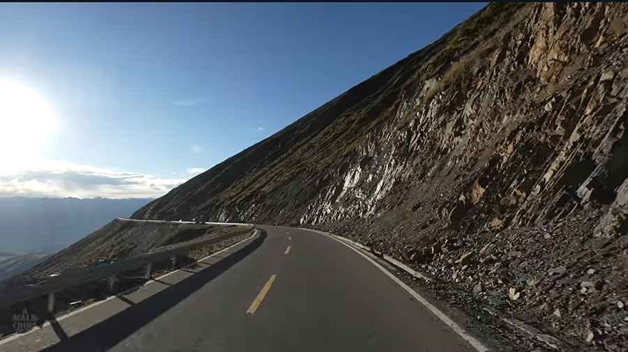
Bairi Pass is a high mountain pass at an elevation of 4,556 meters (14,947 ft) above sea level located in Dawu County, Garzê Tibetan Autonomous Prefecture, Sichuan, in China. Traversed by the paved County Road 179 (X179), the 31.6-kilometer mountain route connects the high Tibetan Plateau with lower valley settlements through 13 sharp hairpin switchbacks.
| Road facts: Bairi Pass (X179) | |
|---|---|
| Location | Dawu County, Garzê, Sichuan (China) |
| Elevation | 4,556 m (14,947 ft) |
| Route Designation | County Road 179 (X179) |
| Length | 31.6 km (19.6 miles) from Dawu |
| Hairpin Switchbacks | 13 turns |
| Surface | Paved asphalt |
| Key Hazards | Relentless downhill grade, brake overheating, sudden fog, mountain trucks on narrow turns |
Where is Bairi Pass located?
The pass is situated on County Road 179 in Dawu County (Daofu), western Sichuan. Starting from the town of Dawu, the 31.6-kilometer paved road climbs up out of the valley onto the high plateau ridge at 4,556 meters.
Is the road over Bairi Pass paved?
Yes. The entire 31.6-kilometer section of County Road 179 is fully paved with asphalt. However, the road remains narrow as it carves through steep-walled gorges, featuring single-lane bottlenecks on tight bends.
How long is the drive over Bairi Pass?
The route covers 31.6 kilometers (19.6 miles) from Dawu. Driving through the 13 sharp hairpins and managing the massive vertical elevation change takes roughly 45 to 60 minutes of low-gear driving.
What hazards exist on County Road 179 over Bairi Pass?
The primary physical hazards are the continuous downhill slope that causes rapid brake overheating, atmospheric oxygen loss at 4,556 meters that reduces engine cooling efficiency, and year-round risk of ice or sudden fog in the upper gorge sections. Heavy local trucks frequently occupy the center of the road on narrow switchbacks.
Road suggested by: Hugh Wilson
Pic&video: Walk China - Driving Channel