How to drive the high-mountain road from Chuzhig to Nyangra?
The road from Chuzhig to Nyangra is a high-altitude paved trip located in Xaitongmoin County, within the Xigazê prefecture of the Tibet Autonomous Region, China. Spanning 44.4 km, this mountain route is a vital link situated to the east of the Lungzang La pass. The road is engineered to traverse extreme terrain, reaching a peak elevation of 5,400m (17,716ft) above sea level.
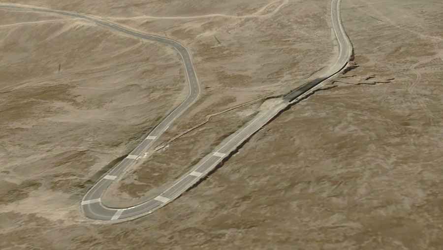
| Road facts: Chuzhig to Nyangra | |
|---|---|
| Location | Xaitongmoin County, Tibet, China |
| Max Elevation | 5,400 m (17,716 ft) |
| Length | 44.4 km (27.5 miles) |
| Hairpin Turns | 35 |
| Elevation Gain/Loss | +884 m / -855 m |
What are the technical challenges of the Chuzhig to Nyangra road?
The 44.4 km road between Chuzhig and Nyangra is a high-concentration driving task. The road is fully paved, which facilitates higher speeds, but the presence of 35 sharp hairpin turns requires constant brake management and precise steering input. The route features an elevation gain of +884 m and a loss of -855 m, creating a profile that alternates between sustained climbs and technical descents.
How to manage the 35 hairpin turns at 5,400m elevation?
Driving the 35 hairpins of the Chuzhig-Nyangra route requires a disciplined approach to lane positioning. Many of these turns are tight and may feature "off-camber" sections that challenge the vehicle's stability. The road runs south-north through a high-altitude desert environment where visibility is usually good, but the lack of safety barriers on the 44.4 km stretch increases the risk during the rapid descents. Drivers must be alert for localized asphalt degradation caused by extreme thermal expansion and contraction at 5,400m altitude.
What is the operational window for this Tibetan high-mountain road?
Set in the heart of the Tibet Autonomous Region, the road between Chuzhig and Nyangra is exposed to extreme weather. Although the pavement is designed for year-round transit, heavy snowfalls and black ice can make the 35 hairpins impassable in minutes. The high-altitude climate means that temperatures can drop well below freezing even in summer. There are no fuel or mechanical services along the 44.4 km route; vehicles must be fully self-sufficient and equipped with high-performance cooling systems to prevent overheating in the thin atmosphere.
Safety protocols for the Chuzhig to Nyangra transit
The main hazard on the road to Nyangra is altitude sickness for both the driver and the vehicle. Brakes must be inspected for fluid integrity, as the -855 m descent can cause rapid heat buildup. It is a mandatory safety protocol to carry supplementary oxygen and verify the vehicle's tire pressure. Communication is limited in this sector of Xaitongmoin County, so notifying local authorities or contacts before starting the 44.4 km drive is a recommended precaution.
Road suggested by: Hugh Wilson