How to Drive the 42 Hairpin Turns of Kulamba Pass?
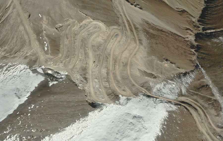
Kulamba Pass is a high mountain pass at an elevation of 4,009 meters (13,152 ft) above sea level located in Kargilik County (Yecheng), Kashgar Prefecture, Xinjiang, in China. The unpaved mountain track gains over 1,200 vertical meters over 21 kilometers, climbing through 42 sharp hairpin switchbacks.
| Road facts: Kulamba Pass | |
|---|---|
| Location | Kargilik County (Yecheng), Xinjiang (China) |
| Elevation | 4,009 m (13,152 ft) |
| Length | 21.0 km (13.0 miles) from Yuye |
| Elevation Gain | 1,217 vertical meters (3,992 ft) |
| Average Gradient | 5.79% |
| Hairpin Switchbacks | 42 turns |
| Surface | Unpaved gravel, scree, and loose dust track |
| Vehicle Requirement | High-clearance 4WD required |
Where is Kulamba Pass located?
The pass is situated in Kargilik County (Yecheng) within the Kashgar Prefecture of southwestern Xinjiang. Starting near Yuye, the 21-kilometer unpaved track climbs 1,217 vertical meters up the high-altitude desert mountains.
Is the road to Kulamba Pass paved?
No. The entire 21-kilometer route is completely unpaved, consisting of loose scree, gravel, and fine dust. The single-lane shelf track lacks safety barriers and features 42 tight switchbacks cut into friable, unstable slopes.
How long is the drive over Kulamba Pass?
The climb covers 21.0 kilometers (13.0 miles) from Yuye to the 4,009-meter summit. Negotiating the 42 loose hairpins and steep gravel ramps requires roughly an hour of continuous low-range 4WD driving.
What hazards exist on Kulamba Pass?
The primary physical hazards are sharp scree stones that cause tire punctures, severe atmospheric oxygen loss at 4,009 meters that reduces engine power, and active rockfalls along the switchbacks. Sudden snowstorms and heavy rainfall turn the unpaved surface into mud and debris flows.