Sangdui La: Driving the high-altitude military frontier at 5,103m
Located just a few kilometers east of its twin pass, Siyaba La, the Sangdui La is an international mountain pass reaching a staggering elevation of 5,103m (16,742ft) above sea level. This high-altitude track sits directly on the border between the Mustang District of Nepal and the Tibet Autonomous Region of China, forming part of a sensitive military corridor in the Himalayas. It's one of the highest roads in the country.
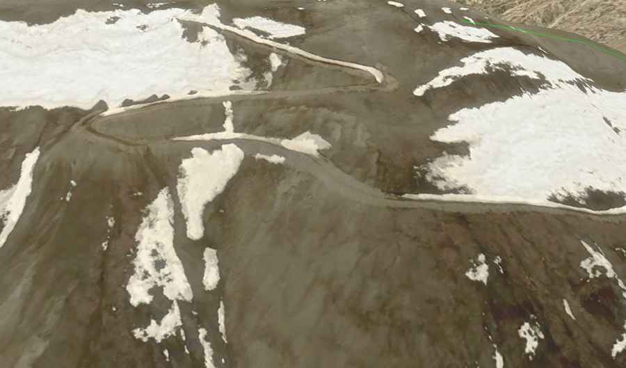
The Sangdui La, situated at the coordinates 29.287944, 84.067667, is one of the highest driveable points in the region. Like its neighbor, it is not a civilian thoroughfare but a restricted military road. The track serves as a strategic link for border patrols and high-altitude surveillance. Due to its extreme location and geopolitical significance, the pass is strictly closed to the general public, making it a "ghost road" for overlanders—a route that exists on satellite maps but remains inaccessible to civilian tires.
| Road facts: Sangdui La (Nepal-Tibet) | |
|---|---|
| Location | Upper Mustang (Nepal) - Xigazê (Tibet) |
| Elevation | 5,103 m (16,742 ft) |
| Road Type | Military Track / Unpaved |
| Status | Strictly Restricted / Closed to Civilians |
| Hazard Level | Extreme (Altitude & Climate) |
What makes Sangdui La a technical driving challenge?
The road to Sangdui La is a brutal example of high-altitude desert driving. The surface is entirely unpaved, consisting of loose scree, volcanic dust, and weathered rock. At an elevation exceeding 5,100 meters, the technical challenge for any 4x4 vehicle is doubled. The internal combustion engine loses nearly 50% of its power due to the lack of oxygen, and cooling systems are pushed to their limits in the thin, dry air. Only high-clearance, heavy-duty military vehicles are capable of navigating the steep gradients and the seasonal ruts carved by snowmelt.
The pass is only physically accessible for a short window during the summer months. For the rest of the year, it is buried under deep snow drifts and battered by hurricane-force winds. There are absolutely no facilities available: no fuel, no shelter, and no medical aid. A breakdown at this altitude is life-threatening, as the nearest settlement in Mustang is a multi-day trek away through some of the most unforgiving terrain on Earth.
The military importance of the Sangdui ridge
Along with Siyaba La, the Sangdui La pass forms a defensive ridgeline monitored by Chinese border guards. The summit often features temporary or permanent fortifications to oversee the vast Tibetan plateau to the north and the deep valleys of Mustang to the south. For travelers exploring the Upper Mustang region of Nepal, these passes represent a "hard border"—a place where the road literally ends at a line of military checkpoints.
While the prospect of reaching such an altitude is enticing for adventure drivers, the reality of the Sangdui La is one of extreme isolation and surveillance. It stands as a reminder of the raw power of the Himalayas, where geography and politics intersect to create routes that remain off-limits to all but a few. If you are exploring the region, remember to respect all local and military signs, as straying towards these passes without authorization can result in immediate detention by border authorities.