Is the military road to Uzbel Pass on the China-Tajikistan border paved?
Forget about your GPS or your travel plans; the Uzbel Pass is a place you will likely never see in person. Sitting at 4,685m (15,370ft) in the heart of the Pamir Mountains, this pass isn't a mountain crossing for travelers—it's a hardcore military zone on the sensitive border between China (Xinjiang) and Tajikistan. If you try to drive here, you won't find a road; you'll find a checkpoint with soldiers who won't be happy to see you.
| Road facts: Uzbel Pass | |
|---|---|
| Location | Xinjiang (China) - Tajikistan Border |
| Elevation | 4,685m (15,370ft) |
| Status | Strictly Military / Restricted Access |
| Surface | Unpaved / Rough Gravel / Loose Slate |
A road built for tanks, not tourists
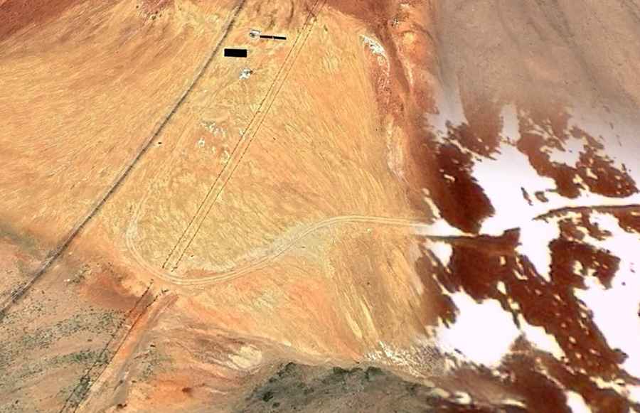
The track leading to Uzbel Pass from the Chinese side (starting near Chongrang) is 72 km of raw, brutal mountain terrain. It is entirely unpaved. This isn't just "gravel"; it's a mix of sharp slate and rocky debris that would shred standard tires in minutes. The road was built and is maintained by the Chinese military to supply high-altitude outposts and surveillance stations. It's wide enough for heavy trucks and armored vehicles, but it’s a bone-shaking ride that hits steep 15% gradients near the summit.
The reality of the border: Barbed wire and radars
This is one of the most monitored borders in Central Asia. China has been pumping millions into new border facilities and high-tech surveillance in this region to secure the frontier. The summit of Uzbel Pass isn't a scenic viewpoint; it's a collection of military bunkers and radar installations. There is a barbed-wire fence running the length of the border, and on the Chinese side, the nearest outpost is just a few kilometers away. Silence here is only broken by the sound of military diesel engines and the freezing wind that never stops blowing.
Can you actually drive to Uzbel Pass?
In short: No. While overlanders dream of crossing the Pamirs, the Uzbel Pass is not an international border crossing for civilians. The only legal crossing between Tajikistan and China is the Kulma Pass, and even that is highly restricted. Approaches to Uzbel on both sides are blocked by military checkpoints. To even get close, you would need special "Border Zone" permits that are almost impossible for independent travelers to get. If you wander into this area without the right paperwork, you're looking at an immediate arrest and deportation.
Extreme weather and altitude
Even if you had the permits, the environment is deadly. At nearly 4,700 meters, there is very little oxygen. The weather is unpredictable; you can go from clear skies to a blinding blizzard in thirty minutes. For seven months of the year, the "road" is buried under deep snowdrifts and blocked by landslides. The slate rock in this part of the Pamirs is unstable, meaning the track is constantly shifting. It’s a place where the mountain is always trying to reclaim the path.
The road to Uzbel Pass is a reminder of how the world's most remote places are often the most guarded. It’s a route for soldiers and heavy machinery, far away from the reach of the average adventurer. Respect the restrictions, stay on the permitted routes like the Karakoram Highway, and focus on the road. Some places are better left seen from a satellite than from the driver's seat.
Road suggested by: Hugh Wilson