How is the unpaved road to Tagu La pass in Tibet?
Tagu La is an extreme high-altitude mountain pass rising to 4,978m (16,332ft) above sea level in Drongpa County, part of the Shigatse Prefecture in the Tibet Autonomous Region. Located in the remote western part of Central Tibet, the journey over this pass is a brutal test of mechanical endurance. At nearly 5,000 meters, the environment is stripped of all modern infrastructure, leaving drivers to face the raw elements of the Tibetan plateau on a track where the air is thin and the ground is unpredictable.
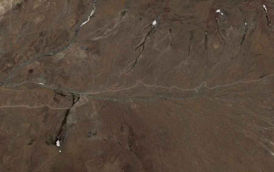
| Road facts: Tagu La | |
|---|---|
| Location | Drongpa County, Shigatse (Tibet) |
| Elevation | 4,978m (16,332ft) |
| Length | 32.5 km (20.2 miles) |
| Surface | Unpaved / Silt / Loose Gravel |
| Hazards | Extreme Altitude / Dust / Isolation |
How long is the road to Tagu La in Shigatse?
The road over Tagu La stretches for 32.5 km (20.2 miles) in an east-west direction, connecting the small settlements of Qusha and Nakangba. While 32 kilometers might seem like a short distance, the average travel time is significantly higher due to the deteriorating state of the unpaved track. The route consists of narrow sections where the loose mountain soil is prone to shifting, especially after a frost. The steep inclines toward the 4,978-meter summit require a steady pace to keep the wheels from spinning on the fine, dry silt that covers much of the track.
What are the mechanical challenges of driving at 4,900 meters?
The primary hazard at Tagu La is the extreme oxygen deficiency. For every 1,000 meters of elevation, an internal combustion engine loses roughly 10% of its power; at the summit, your vehicle will be operating with nearly 50% less torque. This power loss makes the 32.5 km climb a grueling task for the cooling system and the transmission. Furthermore, the high-altitude dust is incredibly fine and can quickly clog air filters, leading to further engine strain. A high-clearance 4x4 is mandatory, not just for traction, but to navigate the deep ruts and rocky outcrops that define this unmaintained Tibetan route.
What is the road surface like on Tagu La during winter?
The track to Tagu La is completely unpaved and becomes exceptionally dangerous during the winter months. Snowfall turns the fine silt and gravel into a slick, treacherous slurry where traction is nearly zero. Because the road is located in a high-wind zone of Shigatse, snowdrifts can quickly bury sections of the track, making it impossible to identify the edge of the road. Even in the height of summer, the ground remains frozen just beneath the surface (permafrost), which can cause sudden "soft spots" where the tires may sink without warning as the top layer thaws during the day.
Is there any support on the road to Tagu La?
Isolation is total on the road between Qusha and Nakangba. There is no electricity, medical aid, or cellular signal along the 32.5 km stretch. If you suffer a mechanical failure or a flat tire, you must be prepared to perform the repairs yourself in an environment where physical exertion is limited by Acute Mountain Sickness (AMS). It is vital to carry extra fuel and several spare tires, as the sharp, frozen rocks on the pass are notorious for slicing through sidewalls. This is a journey through a vacuum of infrastructure where the vehicle's reliability is your only safety net.
Road suggested by: Hugh Wilson