What are the driving hazards of the road to Zong Co Lake in Tibet?
Zong Co (also known as Dzongka Tso or Tingye Gungtso) is a high mountain glacial lake at an elevation of 4,976m (16,325ft) above sea level. Located in Dinggyê County, within the Xigazê prefecture of the Tibet Autonomous Region, the access route is one of the most mechanically demanding unpaved tracks in the southwestern Himalayas. Operating a vehicle at this altitude requires a strict technical protocol to manage both engine efficiency and tire integrity on sharp glacial debris.
| Road facts: Zong Co Lake | |
|---|---|
| Location | Dinggyê County, Tibet (China) |
| Elevation | 4,976 m (16,325 ft) |
| Length | 18.5 km (11.49 miles) |
| Surface | Unpaved (Gravel and Glacial moraine) |
Is the road to Zong Co Lake in Tibet unpaved?
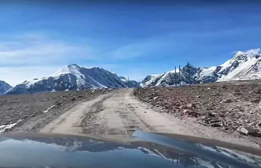
The road to this glacial lake is completely unpaved and follows the natural topography of the valley. Technically, the 18.5 km track from Zhaxigang Village features 11 tight hairpin turns and sustained steep sections. At nearly 5,000m, the oxygen levels are reduced by approximately 45% compared to sea level, which significantly impacts the torque delivery of internal combustion engines. A high-clearance 4x4 vehicle is mandatory, as the track consists of loose gravel and sharp stones that can easily compromise standard road tires.
What are the mechanical risks of driving to Zong Co?
The technical difficulty of the Zong Co transit lies in the combination of steep gradients and low atmospheric pressure. Drivers must monitor the vehicle's cooling system constantly, as the boiling point of coolant drops significantly at this elevation. Logistically, the route is isolated; any mechanical failure or Acute Mountain Sickness (AMS) requires a self-recovery plan, as professional assistance is hours away in Dinggyê. The 11 hairpins are narrow and unbanked, requiring precise steering inputs to avoid the soft edges of the track where the glacial moraine is less stable.
Is the road to Zong Co Lake open in winter?
From a logistical standpoint, the road to Zong Co is seasonally impassable for approximately eight months of the year. Heavy snow accumulation and permafrost conditions typically close the route from late October through late June. Even during the summer months, sudden storms can cause rapid thermal contraction of the road surface, leading to rockfalls or washouts. Safety protocols mandate checking the snow depth at the lower Zhaxigang entrance before attempting the full 18.5 km ascent, as there are very few widening points for a turnaround maneuver on the upper sections.
Road suggested by: Hugh Wilson
Pic & video: XiaoV