Driving the 30 hairpin shelf road to Dawagenzha Peak in Sichuan
Dawagenzha Peak is a high-altitude summit reaching 3,862m (12,670ft) above sea level in Baoxing County, Sichuan Province. For those behind the wheel, the attraction isn't just the 360-degree view of the Qionglai Mountains, but the terrifying "shelf road" that clings to the cliffs with more than 30 hairpins and no room for error.
| Road facts: Dawagenzha Peak | |
|---|---|
| Location | Baoxing County, Sichuan, China |
| Length | 16.9 km (10.5 miles) |
| Max Elevation | 3,862 m (12,670 ft) |
| Average Gradient | 9.62% |
| Surface | Unpaved, loose rock and gravel |
How challenging is the road to Dawagenzha Peak?
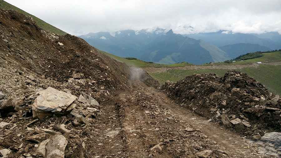
The drive to the summit is a relentless technical challenge. Starting from Liujiazhai, the track climbs 1,626 meters over just 16.9 km. This results in a brutal average gradient of 9.62%, which on an unpaved surface means constant loss of traction if you don't maintain steady momentum. The road is a classic "shelf road": extremely narrow, carved directly into the mountain face, with vertical drops on one side and no guardrails. A high-clearance 4x4 vehicle with a low-range gearbox is mandatory to handle the big rocks and deep ruts that litter the path.
What are the main hazards on the 30 hairpin turns?
The defining feature of the Dawagenzha ascent is the high concentration of switchbacks. More than 30 sharp hairpin turns are packed into the climb, many of them so tight that long-wheelbase vehicles may require multi-point turns on a crumbling edge. The surface is composed of loose volcanic gravel and large stones that shift under the weight of the vehicle. Intense focus is required, as the road is often wide enough for only one car, and meeting oncoming local traffic on these hairpins requires nerve-wracking reversing maneuvers on the brink of the precipice.
Is the road to Dawagenzha Peak open year-round?
Located in the heart of the Qionglai Mountain Range—the same region that hosts the UNESCO Giant Panda Sanctuaries—the peak is subject to extreme weather. From November through April, the road is typically buried under heavy snow and becomes totally impassable. Even in the summer months, the area is prone to sudden, thick fog and heavy monsoon rains that can turn the rock-strewn track into a slippery mudslide. Drivers should only attempt the climb in clear conditions and must be prepared for rapid temperature drops at nearly 4,000 meters.
What should you check before driving to the summit?
Before committing to this 1,626-meter climb, a full mechanical audit is necessary. The 9.62% average gradient will punish your cooling system on the way up and test your brakes to the limit on the way down. Ensure your tires are rated for sharp rocks and that you carry a full-sized spare. Due to the remote location in Sichuan, there is zero support infrastructure on the mountain; if you break an axle or overheat your transmission on one of the 30 hairpins, you are on your own in a very high-altitude environment.
Road suggested by: Hugh Wilson
Pic: 悄然而至