How to drive the high road to Kyakyen La in Tibet?
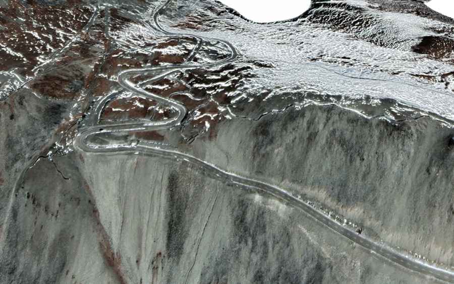
Kyakyen La is a high mountain pass at an elevation of 4,837m (15,869ft) above sea level, located in Cona County, Shannan Prefecture, Tibet Autonomous Region, China. The route runs through the southern mountain range of the Tibetan plateau, passing near the Geching Tso lake basin.
| Road facts: Kyakyen La | |
|---|---|
| Location | Cona County, Shannan, Tibet, China |
| Elevation | 4,837 m (15,869 ft) |
| Length | 30 km (18 miles) |
| Surface | Unpaved / Gravel & Dirt |
How long is the road to Kyakyen La?
The mountain road is 30 km (18 miles) long, running north to south to connect Tsona City with the settlement of Shao. The track scales the slopes of the ridge up to the summit at 4,837 meters before starting the descent toward the southern valley floors.
Is the road to Kyakyen La unpaved?
The road surface is unpaved, consisting of loose gravel, compacted mountain soil, and rocks. The track is single-lane wide with tight switchbacks cut directly into the hillside. Due to the loose stones and steep gradients on the turns, a high-clearance 4x4 vehicle is required to maintain tire traction and avoid undercarriage impacts against loose rocks.
What are the weather hazards at Kyakyen La?
The pass is subject to unpredicted snowstorms and wind exposure throughout the year. Snow accumulations block the traffic lane, closing the route until maintenance crews clear the drifts. The 30-kilometer mountain sector has no mechanical workshops, fuel stations, or roadside assistance services.
Road suggested by: Hugh Wilson