Travel Guide to Gongnaisi Daban in the Tian Shan Mountains
Gongnaisi Daban is a high mountain pass at an elevation of 3,066m (10,059ft) above sea level, located on the boundary between Hejing and Xinyuan counties, in the Xinjiang Uyghur Autonomous Region of China.
Is the road to Gongnaisi Daban paved?
Set high in the central-southern part of the Tian Shan Mountains, the road to the summit is called G218 national road. It is entirely paved, but due to the lack of maintenance, bad weather, and heavy use by trucks and buses, the conditions of the road near the summit are really poor.
How long is Gongnaisi Daban?
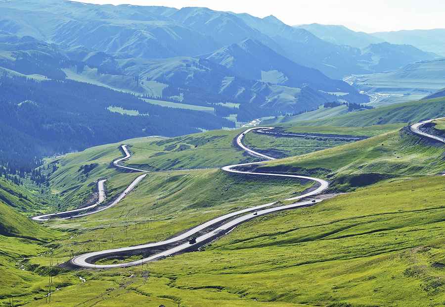
Tucked away in the northwest of the country, the pass, also known as Aiken Daban, is 42.7 km (26.53 miles) long, running west-east from Gongnaisixiang to Haersala. The drive is stunning, with countless hairpin turns, surrounded by breathtaking nature, including fairy grassland and green forests. There’s an ovoo formation near the summit.
Is Gongnaisi Daban open in winters?
The pass is typically open all year round, but short-term closures (heavy rainfall and snowfall) are common from November to May due to dangerous weather conditions. Heavy traffic jams are common. Remember to follow safety signals and stick to the speed limit of 30 km/h in twisty sections.
Road suggested by: jorge manuel gómez sánchez
Pic: Edward Mon