Chure Chu Valley Road: Driving Through Southeastern Tibet
The Chure Chu Valley Road is a mountain route located in the Shannan Prefecture of the southeastern Tibet Autonomous Region. Following the Chure Chu-Xia Chu river valley, this section connects Lhozhag and Comai counties.
Where is the Chure Chu Valley Road located?
The road is situated in the high-altitude Shannan prefecture, straddling the border between Lhozhag and Comai counties. It follows the natural path of the Chure Chu-Xia Chu river valley, characterized by steep, arid slopes and high-altitude mountain terrain.
| ROAD FACTS: CHURE CHU VALLEY ROAD | |
|---|---|
| Length | 71.6 km (44.49 miles) |
| Major Passes | Ba La, Gyal La, Dsa Khar La, Shong La |
| Maximum Elevation | 4,412 m (Shong La) |
| Surface | Unpaved / Loose Gravel |
How long is the Chure Chu Valley Road?
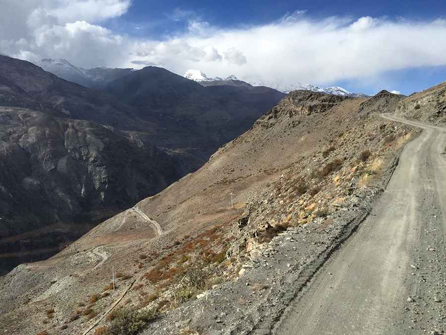
The total length of this section is 71.6 km (44.49 miles). The road is a narrow shelf-track carved into the mountainside with no guardrails or safety barriers.
Is Chure Chu Valley Road paved?
No, the road surface is entirely unpaved, consisting of loose gravel, dirt, and stones. The track is extremely narrow in multiple sections, often allowing only one vehicle to pass at a time. Due to the high risk of landslides and the technical nature of the hairpins, a high-clearance 4x4 vehicle is essential for safety.
What are the main mountain passes on this route?
The journey crosses four significant passes that test vehicle performance:
- Ba La: 3,668 m (12,034 ft)
- Gyal La: 3,875 m (12,713 ft)
- Dsa Khar La: 3,908 m (12,821 ft)
- Shong La: 4,412 m (14,475 ft)
Is the Chure Chu Valley Road open in winter?
The road is typically impassable during the winter months due to extreme cold and heavy snow accumulation on the higher passes like Shong La. The best window for travel is between late spring and early autumn.
Road suggested by: Hugh Wilson
Pic: p. pc高手