How to drive the paved road to Kazi La?
Kazi La is a mountain pass at an elevation of 4,439m (14,563ft) above sea level, located in Litang County, within the Garzê Tibetan Autonomous Prefecture, Sichuan, China. The pass is traversed by a paved segment of the highway.
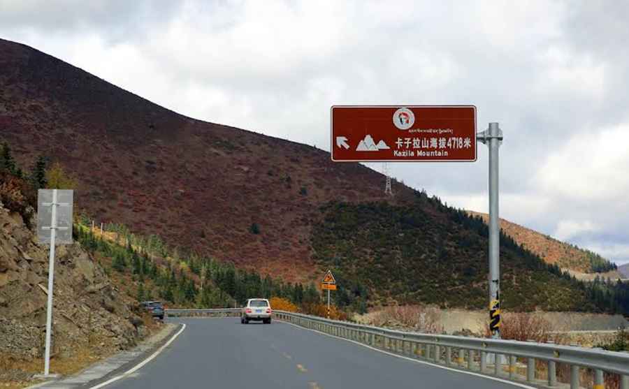
| Road facts: Kazi La | |
|---|---|
| Location | Litang, Garzê Prefecture, Sichuan, China |
| Elevation | 4,439 m (14,563 ft) |
| Length | 20.2 km (12.55 miles) |
| Surface | Paved / Asphalt |
Is the road to Kazi La unpaved?
The road over the summit is paved with asphalt. The pass is part of the National Highway 318 (G318) in China, a freight route connecting Sichuan to Tibet. The mountain highway has two lanes, white road markings, concrete retaining walls, and steel safety barriers on the valley sides.
How long is the road across Kazi La?
The mountain pass segment is 20.2 km (12.55 miles) long, running west to east between Donglaiyicun and Lawuke. The road climbs through the Hengduan Mountains using wide curves. Freight trucks move at low speed up the gradient, forcing cars to make overtaking maneuvers on the single uphill lane.
What are the hazards at Kazi La?
The elevation of 4,439 meters causes engine power loss due to thin air. Alpine fog reduces visibility to a few meters. Ice forms on the asphalt during the night and early morning inside the shaded mountain cuts where the sun does not hit the tarmac.
Is Kazi La open during the winter season?
Highway maintenance crews plow the route year-round to clear snow. Heavy snowstorms close the pass for several hours until machinery removes the drifts. Blizzards turn the tarmac into an ice sheet, requiring drivers to mount snow chains on tires at the valley checkpoints before ascending.
Road suggested by: Hugh Wilson
Pic: 張煜輝