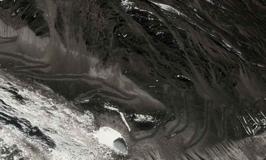
More than 100 hairpin turns to Sangbu La
Sangbu La is an international high mountain pass at an elevation of 5.287m (17,345ft) above sea level, located on the border of China and Bhutan.
Where is Sangbu La?
The pass, also known as Chaagagang La, is located on the border of Lhozhag County of Shannnan, in the south-east of the Tibet Autonomous Region and Lhuntse District in northeastern Bhutan. Facilities like electricity, medical aid, hot running water, western toilets etc. are rare to find. If you do choose this route please check up to date information.
How long is the road to Sangbu La ?
On the Chinese side, the road to the summit is totally unpaved and extremely defiant, with more than 100 hairpin turns. At this elevation oxygen levels drop and visitors need to take adequate precautions against AMS (Acute Mountain Sickness). The military road to the summit is totally impassable in winters. Starting at Bianbaxiang, the ascent is 30.2 km (18.76 miles) long. Over this distance, the elevation gain is 1822 m. The average gradient is 6.03%. On the Bhutanese side there’s no road to the summit.
Road suggested by: Hugh Wilson