Ilfsu Pass: Driving the 25 hairpins of the Gaijiake Daban
Ilfsu Pass, known locally as Gaijiake Daban, is a high mountain pass at an elevation of 4,858 meters (15,938 ft) above sea level, located in Taxkorgan Tajik Autonomous County, within the Kashgar Prefecture of the Xinjiang Autonomous Region, China. Positioned in the westernmost fringes of the Karakoram range, the pass runs close to the borders with Pakistan and Tajikistan.
| Road facts: Ilfsu Pass (Gaijiake Daban) | |
|---|---|
| Location | Taxkorgan, Xinjiang (China) |
| Elevation | 4,858 m (15,938 ft) |
| Length | 35 km (21.74 miles) from G314 |
| Hairpin Turns | 25 switchbacks |
| Surface | Unpaved (Loose scree, sand, and stones) |
| Access | Restricted Border Zone Permits Required |
Where does the unpaved track to Ilfsu Pass start?
The unpaved mountain track spans 35 kilometers (21.74 miles), running west to east from the paved G314 highway, widely known as the Karakoram Highway, to the small outpost of Gaijieke. The single-lane road cuts through the remote valleys of the Pamir plateau, climbing directly to the 4,858-meter summit crest. Due to its position along sensitive military frontier lines, armed checkpoints block the access ramps, and driving the route requires specific border permits issued by the Kashgar Prefecture.
What are the hazards on the 25 hairpins of Gaijiake Daban?
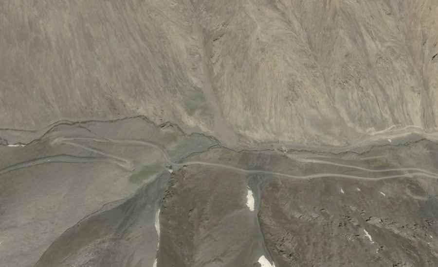
The main driving hazard of the 35-kilometer route is a steep sequence of 25 sharp hairpin turns that zigzag up the exposed mountain flanks. The trackbed consists of raw, unmaintained dirt, loose scree, and large gravel shards that shift under vehicle weight. A high-clearance 4x4 vehicle with a low-range transfer case is required to clear the tight switchbacks without losing tire grip, especially since the 4,858-meter altitude reduces engine power and torque. The narrow lane completely lacks side safety guardrails or barriers above the drops.
Is the Ilfsu Pass road open in winter?
Due to its high altitude in western Xinjiang, the pass faces severe freezing temperatures and is completely buried under heavy snowdrifts and solid ice fields from October until late June, remaining entirely impassable. The military track receives no civilian winter clearing services. During the short summer months, sudden alpine blizzards can drop the temperature below freezing instantly, transforming the dusty switchbacks into slick mud traps and causing rockfalls from the cliffs above the track.
Road suggested by: Hugh Wilson