The Road to Gong La: Navigating 102 Hairpin Turns on Tibet’s Border
Located in Lhozhag County, within the Shannan Prefecture of the Tibet Autonomous Region, the road from Lakangzhen to Gong La is one of the most demanding high-altitude drives in the Himalayas. This remote mining track winds its way through the rugged mountains near the border with Bhutan, offering a brutal but breathtaking experience for experienced off-roaders.
| Road facts: Lakangzhen to Gong La | |
|---|---|
| Location | Lhozhag County, Tibet (China) |
| Length | 58.8 km (36.5 miles) |
| Max Elevation | 4,991m (Bod La) |
| Hairpin Turns | 102 |
How long is the road from Lakangzhen to Gong La?
The journey spans 58.8 kilometers (36.5 miles), starting from the paved G219 highway near the town of Lakangzhen. Despite the relatively short distance, the climb is relentless. The road is a dedicated mining track that ascends to two major high-altitude passes: first reaching Bod La at 4,991m (16,374ft), and finally ending at Gong La at 4,800m (15,748ft). Due to the terrain, expect to spend several hours behind the wheel to complete this section.
Is the road from Lakangzhen to Gong La difficult?
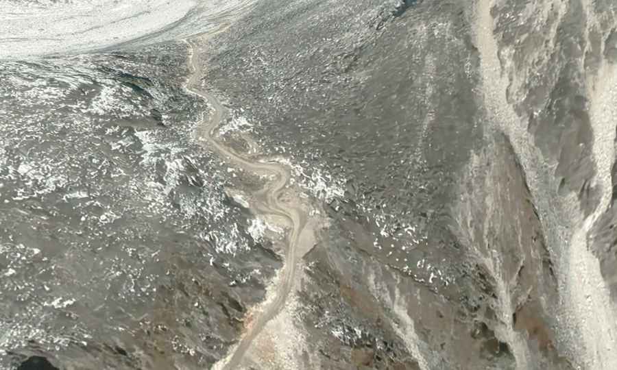
This is definitely not a Sunday drive. The road is entirely unpaved and famous for its extreme geometry, featuring a staggering 102 hairpin turns. These switchbacks are tight, steep, and often lack any form of protection or guardrails.
Driving challenges include:
- Mechanical Strain: The combination of steep gradients and thin air at nearly 5,000 meters will test any engine's cooling and power systems. A high-clearance 4x4 is essential.
- Extreme Exposure: The road clings to the side of the mountains with massive vertical drops. Precision steering is required, especially when encountering mining trucks coming in the opposite direction.
- Border Sensitivity: Being so close to the Bhutanese border, this is a sensitive area. Travelers should ensure they have all necessary permits (Tibet Travel Permit and Alien Travel Permit) before attempting the route.
What can you see from the Gong La pass?
For those who brave the 102 hairpins, the rewards are immense. Near the end of the track at Gong La, the road offers unique views across the border into Bhutan, including the stunning Tsho Kar lake. The landscape is a stark mix of high-altitude desert and snow-capped peaks, far removed from any civilization.
When is the best time to drive to Gong La?
The road is usually impassable from late October through late June or early July. Heavy snowfall blocks the high passes of Bod La and Gong La for most of the year. Even in the summer months, the weather is unpredictable. Sudden storms can turn the dirt track into a mud trap, and landslides are a constant risk in this part of the Himalayas.
Safety and Practical Advice
Since this is a mining road, the surface is rough and unmaintained. Always check the condition of your brakes and tires before starting the climb. There are no facilities along the route, so you must carry enough fuel, food, and emergency supplies to survive a breakdown at high altitude. Oxygen canisters are highly recommended for anyone not fully acclimated to the Tibetan Plateau.
Road suggested by: Hugh Wilson