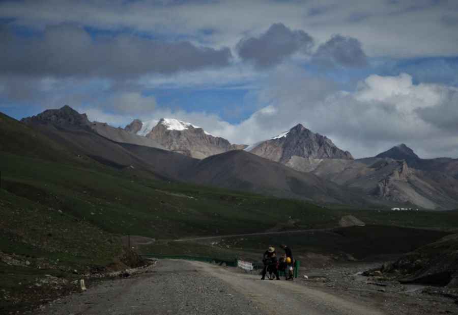
Riadong La: Driving the remote S224 road in the Qiajajima Mountains
At an elevation of 5,005m (16,420ft) above sea level, Riadong La is a high mountain pass located on the border of Zadoi and Zhidoi counties, in the Yushu Prefecture of Qinghai, China. This crossing is part of a wild and recently developed corridor that penetrates the high-altitude wilderness of the eastern Tibetan Plateau.
| Road facts: Riadong La | |
|---|---|
| Location | Yushu Prefecture, Qinghai, China |
| Elevation | 5,005 m (16,420 ft) |
| Road Number | S224 Road |
| Distance | 198 km (123 miles) |
| Surface | Unpaved / Gravel |
Where is Riadong La located?
The pass is situated within the remote Qiajajima mountain range, a geographical divide positioned strategically between the upper reaches of the Mekong and Yangtze rivers. This region is part of the Sanjiangyuan (Three-River-Source) National Nature Reserve. The road runs just above the Angqiansong River, following a rugged path through high alpine tundra where trees are non-existent due to the extreme altitude.
Is the road to Riadong La unpaved?
Yes, the road to the summit, designated as the S224, is entirely unpaved. While it is a recently built route, it consists primarily of loose gravel and dirt. The surface is subject to rapid deterioration due to the harsh climate and heavy seasonal runoff. A high-clearance 4x4 vehicle is essential for this drive. Drivers will face washboard sections, deep dust during dry spells, and thick mud after storms. There are no safety barriers, and the track often narrows as it clings to the riverside cliffs.
How long is the road to Riadong La?
The entire journey spans 198 km (123 miles), running north to south from Zhidoi to Zadoi. Driving the full length without significant stops takes most people between 8 and 9 hours. This long duration is due to the technical nature of the unpaved surface and the constant altitude—much of the route stays well above 4,000 meters. There are no gas stations or repair shops between the two towns, so self-sufficiency is mandatory.
What are the main hazards on the S224?
The primary hazards are altitude sickness (AMS) and mechanical failure. At 5,005 meters, oxygen levels are extremely low, affecting both human concentration and engine performance. Sudden weather changes can bring snow or heavy sleet even in August, making the gravel road dangerously slippery. Due to the proximity to the Angqiansong river, sections of the road are also prone to bank erosion and flash floods. Always carry extra fuel, a satellite communication device, and oxygen supplies before attempting this crossing.
When is the best time to cross Riadong La?
The pass is generally only accessible from late June to early September. For the rest of the year, heavy snow and extreme sub-zero temperatures make the S224 impassable for standard vehicles. Even in summer, night temperatures frequently drop below freezing. If you encounter heavy rain, it is best to stop and wait, as the "recently built" roadbeds in this part of Tibet are notorious for washing out under pressure from the high-altitude river systems.
Road suggested by: Hugh Wilson
Pic&more info: https://asian-alpine-e-news.com/asian_alpine_e-new_issue_no35.pdf