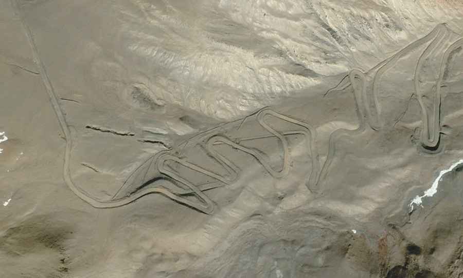
Driving the curvy unpaved road to the summit of Shera La
Shera La is a high mountain pass at an elevation of 5.563m (18,251ft) above sea level, located in the Shannan Prefecture of Tibet, in China. It’s one of the highest roads of the country.
Where is Shera La?
The pass, also known as Maesar La, is located to the east of Puma Yumco lake, on the boundary of Comai and Lhozhag counties.
Is the road to Shera La unpaved?
The road to the summit is totally unpaved, curvy and narrow in parts. The drive is very steep, hitting a 9% of maximum gradient through some of the ramps. A 4x4 vehicle is required.
How long is the road to Shera La?
It’s 82.7 km (51.38 miles) long running west-east from G219 Road to Comai Town.
Is the road to Shera La open year-round?
Set high in the Himalaya, the road is impassable in winters due to heavy snowfalls.
Road suggested by: Hugh Wilson