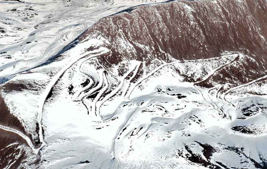
Driving the unpaved road to Lenglongling Pass in China
Lenglongling Pass is a high-altitude mountain crossing at an elevation of 4,254m (13,956ft) above sea level, situated on the boundary between Menyuan County (Qinghai) and Sunan County (Gansu) in China. This 64.8 km (40.2 miles) unpaved corridor is a critical but remote link in the Qilian Mountains.
| Road facts: Lenglongling Pass | |
|---|---|
| Location | Qinghai-Gansu Border, China |
| Elevation | 4,254 m (13,956 ft) |
| Length | 64.8 km (40.2 miles) |
| Surface | Totally Unpaved / Gravel |
| Drive Time | 3–4 hours (low range suggested) |
How challenging is the road to Lenglongling Pass?
The 64.8 km (40.2 miles) route to Lenglongling Pass runs west-east, connecting the Ningzhang Highway (G227) with the X001 Road. Technically, the road is a high-mountain gravel track characterized by its high frequency of sharp turns and steep ramps. Logistically, completing the transit takes between 3 and 4 hours due to the deteriorating surface and the 4,254m elevation, which severely impacts engine power. A high-clearance 4x4 vehicle is mandatory to manage the loose scree and the potential for deep ruts caused by heavy rain or melting snow on the pass.
What are the driving conditions between Qinghai and Gansu?
Driving through Lenglongling Pass involves crossing an extremely remote section of the Qilian range. Technically, the road lacks any form of stabilization or safety barriers along the most exposed sections. Logistically, the boundary between Menyuan and Sunan counties is subject to rapid weather shifts, including sudden snowfalls and high-altitude fog that can reduce visibility to near zero. Drivers must be prepared for total self-sufficiency, as the 64.8 km stretch offers no services or mechanical support, making any technical failure a high-risk scenario in this isolated high-mountain environment.
Is the Lenglongling Pass open to traffic year-round?
Due to its summit altitude of nearly 14,000ft, Lenglongling Pass is frequently impassable during the winter months. Logistically, heavy snow accumulations and black ice on the unpaved gradients make the 64.8 km corridor extremely dangerous from late October to May. Technically, even during the summer operating window, the roadbed is prone to geological instability. Before attempting the drive between the G227 and X001, it is essential to carry extra fuel and thermal gear, as the thin air at 4,254m affects both human physical response and vehicle performance during the sustained climb.
Road suggested by: Hugh Wilson