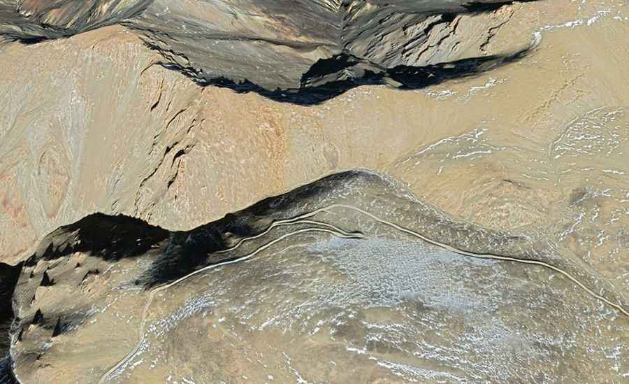
Driving the remote Xila Daban: A 5.292m military track in Ngari
Located in the extreme west of the Tibet Autonomous Region, near the sensitive border with India, the road to Xila Daban is a high-altitude endurance test. Reaching an elevation of 5,292m (17,362ft) above sea level in Zanda County, this unpaved route is a strategic link that serves remote border patrol facilities like Qipu Jilie. It is a journey through the desolate beauty of the Ngari Prefecture, where the vertical scale and the absolute lack of infrastructure demand a vehicle prepared for the harshest conditions on the plateau.
| Road facts: Xila Daban | |
|---|---|
| Location | Zanda County, Ngari (Tibet) |
| Elevation | 5,292 m (17,362 ft) |
| Length | 99.7 km (61.9 miles) |
| Surface | Unpaved / Gravel / Dirt |
| Max Gradient | 7% |
How challenging is the 100km unpaved transit to Xila Daban?
The 99.7 km journey between Menduo and the Qipu Jilie patrol facility is a relentless mechanical grind. While the maximum gradient of 7% might seem moderate, at an altitude of over 5,200 meters, it becomes a major obstacle. The notorious absence of oxygen at this elevation reduces engine torque significantly, forcing even heavy-duty 4x4s into low-range gears to maintain momentum on the steep ramps. The road surface is entirely unpaved, consisting of fine glacial dust and loose stones that can easily mask deep ruts or sharp shale capable of destroying tires and suspension systems. Navigating this narrow track requires constant focus, as the high-altitude environment offers zero margin for mechanical error.
What are the hazards of the Zanda County border patrol roads?
The road to Xila Daban is one of the most isolated transits in the Ngari Prefecture. The primary hazard is the absolute lack of support; in this 100 km stretch, there is no electricity, medical aid, or civilian infrastructure. Sudden weather changes are a constant threat, with blizzards possible even in summer, turning the dirt path into a muddy trap. The proximity to the border means the road is frequently used by military furgonetes and heavy equipment, which can leave the hairpins in a badly degraded state. The thin air doesn't just affect the engine; it causes rapid driver fatigue and altitude sickness (AMS), making the "countless bends" of the Ngari ridges a serious test of situational awareness.
What is the best driving strategy for the extreme west of Tibet?
Reaching 5,292m in a vehicle requires a strictly logistical mindset. You must carry extra fuel, multiple spare tires, and cold-weather survival gear, as a breakdown in this remote sector is a life-threatening emergency. On the descent from Xila Daban, do not rely on your foot brakes; the combination of the long distance and thin air will lead to rapid brake fade. Instead, engage heavy engine braking and maintain a steady crawl through the most exposed sectors. Monitor your vehicle's cooling system and tire pressure constantly, as the transition between the heat of the lower valleys and the freezing temperatures of the pass is extreme. In this part of Tibet, the road is a mission—respect the altitude, watch the ruts, and stay alert for sudden storms.
Road suggested by: Hugh Wilson