Driving the G227 through Eboling Pass: The 22% wall of the Qilian Mountains
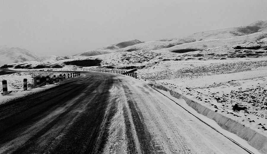
Located on the high-altitude boundary between the Qinghai and Gansu provinces, the Eboling Pass (also known as Biandukou or Oboling) is one of the most mechanically demanding sectors of the G227 Ningzhang Highway. Reaching an elevation of 3,700m (12,139ft) above sea level in the Qilian Mountains, this paved route is a vital interprovincial link that transforms into a technical trap when the temperature drops. It is a journey where the vertical scale of the ramps and the unpredictable grip of the asphalt demand absolute focus from every operator.
| Road facts: Eboling Pass (G227) | |
|---|---|
| Location | Qinghai/Gansu border, China |
| Elevation | 3,700 m (12,139 ft) |
| Length | 45 km (27.9 miles) |
| Max Gradient | 22% |
| Surface | Paved Asphalt |
How punishing are the 22% ramps of the Eboling Pass?
The 45 km transit between Ebuzhen and Nanfengxiang is a high-stakes climb that defies the standard logic of paved highways. While the G227 is entirely asphalted, it features extreme ramps that hit a maximum gradient of 22%. At 3,700 meters, this incline puts an enormous strain on heavy-duty furgonetes and freight trucks, as the thin air reduces engine cooling efficiency and torque. Navigating the tight hairpin turns on such a steep slope requires constant monitoring of your gear selection to avoid losing momentum. The road surface is often slick with condensation or hidden ice, making these 22% sectors a primary hazard for vehicles without high-torque delivery or high-performance braking systems.
What are the hazards of the Qilian Mountains winter transit?
The Eboling Pass is notorious for its long closures, often remaining impassable from late October until early July. As seen on the high-altitude plateaus of Haibei Tibetan Autonomous Prefecture, the primary hazard is the "black ice" that forms on the dark asphalt, making the hairpins nearly impossible to drive safely without specialized equipment. The pass is subject to gale-force winds and sudden blizzards that can bury the road in minutes. Even when the road is officially open, the transition between snowmelt and night-time freezing leaves the pavement in a constant state of flux, where the unprotected shoulders offer no margin for error during a slide. This is a strategic transit where the cold and the wind are as dangerous as the gradient itself.
What is the best mechanical strategy for the G227 descent?
Descending from 3,700m toward Gansu requires a disciplined approach to thermal management. The 22% ramps mean that relying on your foot brakes is a recipe for catastrophic brake fade. You must engage heavy engine braking to control the vehicle's descent, especially through the series of curves and hairpins that define the 45 km stretch. Watch the road far ahead for heavy-duty trucks that may be struggling with the incline or the slippery surface. In this part of China, the road is a test of attrition—monitor your tire grip on the wet asphalt, stay in a low gear through the steepest ramps, and never underestimate the verticality of the Qilian ridges.
Road suggested by: Hugh Wilson
Pic: John Lee李駿