How to drive the 5,915m military road to Medo La?
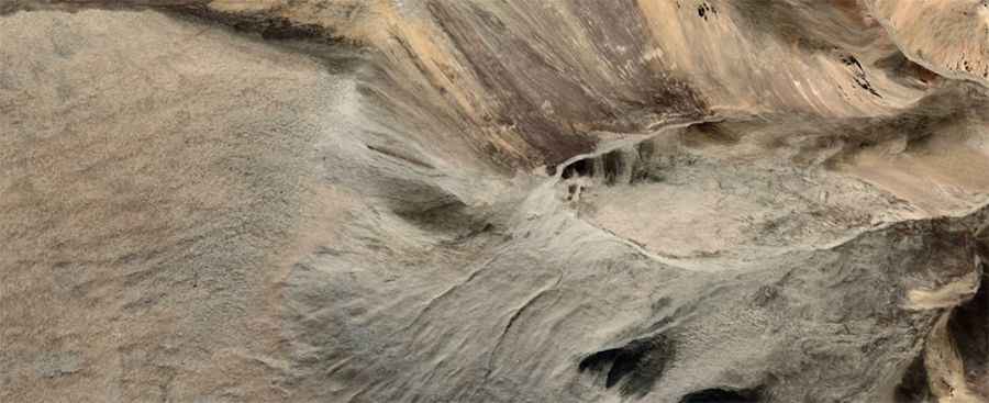
Medo La is an international high mountain pass at an elevation of 5,915m (19,406ft) above sea level, situated on the border between China (Kamba County, Tibet) and India (Sikkim). Finished in 2021, this purely military road is one of the highest motorable road passes in the world. The route is a strategic logistical corridor located in a totally isolated area, requiring specialized 4x4 vehicles and military authorization that is extremely difficult to obtain due to its proximity to the sensitive international border.
| Road facts: Medo La | |
|---|---|
| Location | China (Tibet) - India (Sikkim) Border |
| Elevation | 5,915 m (19,406 ft) |
| Length | 22.1 km (13.7 miles) |
| Elevation Gain | 1,363 m |
| Average Gradient | 6.16% |
What are the technical driving challenges of the Medo La climb?
The 22.1 km ascent from Gamba to the summit of Medo La involves an elevation gain of 1,363 meters. While the average gradient is 6.16%, the logistical difficulty is defined by the extreme altitude. As one of the highest mountain passes of China, the road is totally unpaved despite being a "black-topped" military grade track in some sections. Technically, a 4x4 vehicle is mandatory to navigate the steepness and the loose surface. Drivers must maintain a steady momentum, as the lack of oxygen at nearly 6,000 meters severely impacts engine combustion cycles and torque delivery.
How does the 5,915m altitude affect vehicle mechanics at Medo La?
At an elevation of 5,915 meters, atmospheric pressure is approximately 50% of sea level. Logistically, this results in a critical drop in engine power. Turbocharged diesel engines are a technical requirement to compensate for the thin air, but even these systems face overheating risks because the air is too thin to provide efficient cooling through the radiator. Furthermore, at this altitude, fuel systems can suffer from vapor lock. It is a mandatory protocol for military convoys to carry redundant cooling components and monitor tire pressures, as the pressure differential at 19,406ft can affect the integrity of the tire carcasses on the rocky unpaved surface.
What are the logistical restrictions and access protocols for Medo La?
Access to Medo La is strictly regulated by military authorities. Logistically, the road is located in a high-security zone between Sikkim and Kamba County. Obtaining authorization is technically difficult even for nationals, as the area is totally isolated and lacks any civilian support infrastructure. There are no fuel stations, mechanical workshops, or medical facilities for hundreds of kilometers. Any authorized transit must be entirely self-sufficient, carrying enough fuel to account for the high consumption rates caused by low-gear driving and the physical stress of the 22.1 km climb.
What are the physiological hazards for drivers on the Medo La road?
The climb to 5,915m tests the human organism to its limits. Logistically, the notorious lack of oxygen makes the 22.1 km transit from Gamba extremely hazardous. Most drivers and passengers will experience severe symptoms of Acute Mountain Sickness (AMS). Technical safety protocols must include the use of portable oxygen systems inside the vehicle. The high degree of steepness and the mental fatigue caused by hypoxia require maximum focus, as the narrow military track offers no logistical margin for error. Descending is equally technical; engine braking is essential to manage the -1,363 m drop while the driver's reaction times are slowed by the extreme altitude.
Road suggested by: Vroom