Gola La: Driving the unpaved 5,247m Y651 road in Tibet
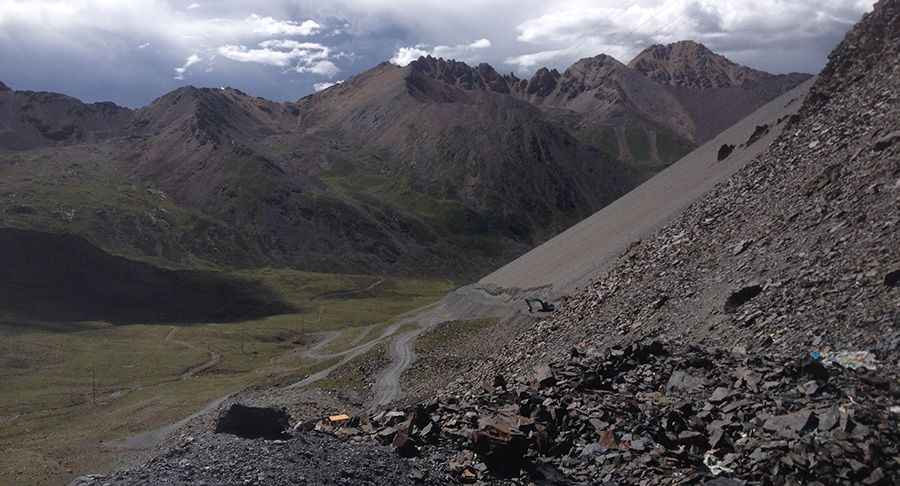
Gola La is a high mountain pass at an elevation of 5,247 meters (17,214 ft) above sea level, located in Lhari County, within the Nagqu Prefecture of Tibet. The road through the pass is part of the Y651, a 54.4-kilometer unpaved track that follows the Yi’ong Zangbo valley. At over 5,200 meters, the lack of oxygen causes a massive loss in engine torque, and the low boiling point of water at this altitude puts extreme stress on the vehicle's cooling system.
| Road facts: Gola La (Y651) | |
|---|---|
| Location | Lhari, Tibet, China |
| Elevation | 5,247 m (17,214 ft) |
| Length | 54.4 km (33.8 miles) |
| Max Gradient | 12% |
Where is Gola La located?
The pass is situated in the eastern part of the Tibet Autonomous Region, in Lhari County. It crosses a remote sector of the Nyainqentanglha Mountains, connecting the high valleys of the Nagqu region. This is an extremely isolated area with no permanent settlements, gas stations, or cell phone coverage along the entire 54-kilometer route. The track follows the Yi’ong Zangbo river, navigating a high-altitude wilderness where self-sufficiency is mandatory.
Is the road to Gola La unpaved?
Yes, the Y651 road is entirely unpaved and consists of loose gravel, large stones, and sandy sections. The track is often narrow and follows ledges with no safety barriers or guardrails. Landslides and river erosion frequently damage the roadbed, requiring a high-clearance 4x4 to navigate the deep ruts and rocky debris. During the summer, snowmelt can turn sections of the track into mud traps, while in winter, the pass is often blocked by deep snow and ice.
How long is the road to Gola La?
The journey spans 54.4 kilometers (33.8 miles) through the mountains. Due to the extreme altitude of 5,247 meters, naturally aspirated engines lose nearly half of their power, making the 12% ramps a significant challenge. You must drive in low gears for most of the transit, which increases fuel consumption and causes the motor to run much hotter than usual. It is essential to carry auxiliary fuel and water, as there is zero traffic to assist in case of a mechanical failure.
Is the road to Gola La open in winter?
The pass is typically impassable from late autumn until June due to heavy snow and sub-zero temperatures. Even in the summer, sudden blizzards can occur at any time. The descent is hard on the braking system; you must use engine braking to avoid boiling the fluid on the steep gradients. Before attempting the crossing, verify that your cooling fan, tires, and battery are in perfect condition, as the isolation in this part of Tibet is total and help is hundreds of kilometers away.
Road suggested by: Hugh Wilson
Pic: Yunfeng Tian