Driving to Changlung Pangtung La: A 5.647m military mission in Xinjiang
Located in the remote Xinjiang autonomous region of Northwest China, the ascent to Changlung Pangtung La is a high-altitude operation that pushes motorized travel to its absolute limit. Reaching a staggering elevation of 5,647m (18,526ft) above sea level, this is one of the highest roads on the planet. It is a strictly functional military track where the vertical scale of the mountains and the geopolitical isolation of the Kunlun range create an environment where mechanical survival is the only priority.
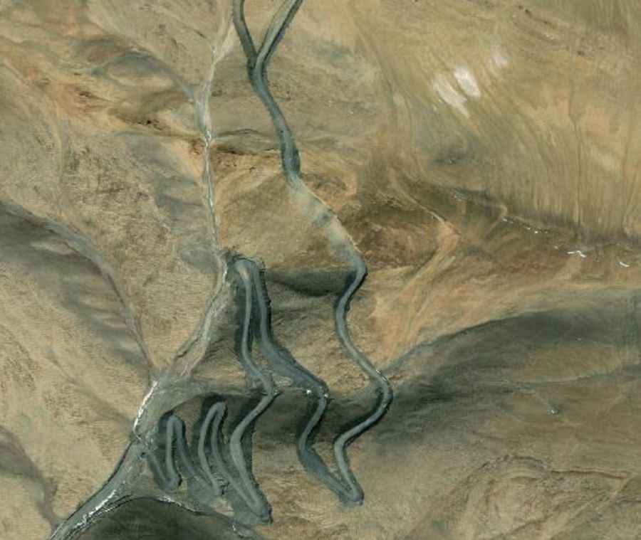
| Road facts: Changlung Pangtung La | |
|---|---|
| Location | Xinjiang Autonomous Region (China) |
| Elevation | 5,647 m (18,526 ft) |
| Length | 55.4 km (from G695 Road) |
| Max Gradient | 14% |
| Surface | Unpaved / Strategic Military Track |
How does the 5,647m altitude affect a drive to Changlung Pangtung La?
The 55.4 km climb starting from the G695 Road is a relentless mechanical grind. At an elevation of over 5,600 meters, the notorious absence of oxygen is the primary hazard for any vehicle. Engines face a massive drop in power output, and the low atmospheric pressure means that cooling systems will boil at much lower temperatures than usual. Navigating the unpaved ramps, which hit a maximum gradient of 14%, requires a high-clearance 4x4 and a driver who knows how to manage torque in thin air. This is a purely military road designed for heavy-duty furgonetes and strategic transport; the surface is a mix of fine dust, loose shale, and deep ruts that can swallow a tire if you lose momentum.
What are the hazards of the remote Xinjiang military zones?
Operating in the high-altitude deserts of Xinjiang means total isolation from civilian infrastructure. The Changlung Pangtung Pass is located in a "dead zone" where medical aid, electricity, and basic supplies do not exist. To the west of the main pass, another secondary military road climbs to 5,591m, leading deep into isolated gorges. The primary hazard here is the extreme weather; gale-force winds and sudden blizzards can occur even in the height of summer, turning the steep ramps into icy traps. The road is unprotected, and the thin air makes any physical exertion—like changing a flat tire—a high-risk activity due to the danger of Acute Mountain Sickness (AMS).
What is the best driving strategy for the highest mountain passes of China?
Reaching the summit of Changlung Pangtung La requires a vehicle in peak mechanical condition, specifically regarding the air intake and cooling systems. As one of the highest mountain passes of China, the descent is just as dangerous as the climb. You must engage heavy engine braking to control your speed on the 14% slopes, as the thin air reduces the cooling efficiency of your brake discs, leading to rapid brake fade. Carry extra fuel, satellite communication, and cold-weather gear. In this part of the northwest, the road is a mission of attrition—monitor your gauges constantly, pick your line through the loose stones, and respect the lethal scale of the Xinjiang ridges.
Road suggested by: Vroom