Chun La: Driving the Bingchacha Line in Southeast Tibet
Reaching an elevation of 4,516m (14,816ft) above sea level, Chun La is a high mountain pass in Zayü County, within the Nyingchi Prefecture of Tibet. The pass is a critical and technical point on the Bingchacha Line (Chacha Highway), widely regarded as the most primitive and demanding overland route connecting Yunnan to southeastern Tibet.
| Road facts: Chun La (Bingchacha Line) | |
|---|---|
| Location | Zayü County, Nyingchi, Tibet |
| Elevation | 4,516 m (14,816 ft) |
| Length | 39 km (24.2 miles) |
| Surface | Unpaved (Mud, Scree, Quicksand) |
| Vehicle Required | Heavy-duty 4x4 |
How long is the road through Chun La?
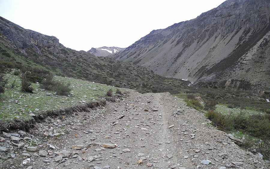
The traverse spans 39 km (24.2 miles), running west to east between the settlements of Murub and Kaidag. The road is entirely unpaved and suffers from a total lack of maintenance due to its extreme isolation. The technical core of the ascent is a 14 km section featuring 23 tight hairpin turns. Because the road is carved directly into rolling stone slopes, the track is constantly shifting, requiring drivers to navigate deep ruts and large boulders that frequently fall from the cliffs above.
Is the Bingchacha Line dangerous in winter?
While technically listed as open year-round, Chun La is subject to perpetual snow patches and high-altitude ice that never melts. In winter, the pass becomes extremely hazardous as the unpaved surface turns into a mix of frozen mud and deep snow drifts. The climate in the Nyingchi Prefecture is highly unpredictable; even in summer, a single storm can turn the steep ramps into an impassable mud trap. Tire chains and recovery gear are essential items for any transit attempts outside of the peak dry season.
What are the driving hazards on Chun La?
The primary hazards are geological instability and thin air. The road crosses sections of "rolling stone" slopes where large quicksands can form after rainfall, threatening to trap even heavy-duty 4x4s. The cliffs are long and unprotected, and the track is often only wide enough for a single vehicle. At 4,500 meters, engine power is reduced by approximately 30%, making the steep, muddy hairpins difficult to manage without low-range gearing. Constant vigilance is required to spot and avoid falling rocks that litter the track after any seismic or weather event.
Logistical considerations for the Zayü region
Self-sufficiency is mandatory when driving the Bingchacha Line. There are no fuel stations, repair shops, or medical facilities between Murub and Kaidag. Vehicles must be equipped with at least two full-size spare tires and a high-lift jack to manage punctures from sharp Himalayan scree. Due to the extreme remoteness, it is highly recommended to travel in a convoy of at least two vehicles. Ensure your cooling system is in optimal condition, as the sustained low-gear climb at high altitude puts immense thermal stress on the engine.
Road suggested by: Hugh Wilson
Pic: 程亮