Driving the paved G349 road to Ka La in Tibet
Ka La is a high mountain pass at an elevation of 4,805m (15,764ft) above sea level, located in the Tibet Autonomous Region of China. Situated in a remote and barren landscape, the pass is an essential link in the high-altitude road network of western Tibet.
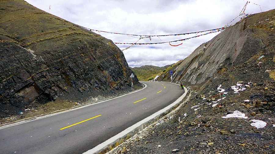
The pass is characterized by its dramatic geological formations, with slopes of dark, fragmented rock and sparse vegetation. It is a place of extreme spiritual and physical significance, where prayer flags often flutter in the relentless Himalayan winds. The air at this altitude is thin, containing only about half the oxygen found at sea level, making it a challenging environment for even the most experienced high-altitude travelers.
| Road facts: Ka La | |
|---|---|
| Location | Tibet (China) |
| Elevation | 4,805m (15,764ft) |
| Road Name | National Highway G349 |
| Length | 61.5 km (38.21 miles) |
| Surface | Paved / Asphalt |
Is the road to Ka La in Tibet difficult to drive?
The road over the summit is fully paved and forms part of the National Highway G349. While the asphalt is in good condition, the drive is exceptionally demanding due to the extreme altitude. Although the Ka La summit sits at 4,805m, the G349 road is long and arduous, crossing several other passes and maintaining stretches firmly at altitudes over 5,000 meters. For any unacclimatized traveler, these heights can be dangerous, making proper preparation and gradual ascent essential.
How long is the G349 through Ka La?
The journey spans 61.5 km (38.21 miles), running west-east from Sangsang to Kagazhen. The route winds through some of the most inhospitable and uninhabited terrain on the planet, where nighttime temperatures can plummet to -25°C or lower. Despite its isolation, the road provides access to a number of important historical and religious sites. Travelers should be aware that because of the extreme high altitude, winter seasons are incredibly harsh with strong gusts of wind, and sections of the road may close due to heavy snowfall even outside the peak winter months.
What are the driving conditions like at Ka La?
Expect a journey through a high-altitude desert where the atmosphere is extremely arid. The road is a windy corridor where you can often feel strong gusts coming from multiple directions simultaneously. While the modern paving has improved travel times, the G349 remains a remote route with long distances between service points. It is wise to carry emergency supplies, including food and water, as you traverse these desolate stretches. During the monsoon season (July and August), heavy rains can still impact travel, but the paved surface provides a reliable link compared to the older gravel trails of the region.
Road suggested by: Hugh Wilson
Pic: 程亮