Is the road to Bayi Daban in the Kunlun Mountains difficult to drive?
Reaching the Bayi Daban is a journey into one of the most desolate and oxygen-starved corners of the planet. At 5,366m (17,604ft) above sea level, this pass—also known as Lingkyithang La—sits on the brutal boundary between Xinjiang and the Ngari Prefecture of Tibet. This isn't just a road; it’s a test of survival for your vehicle’s engine and your own lungs. At this elevation, the sky feels dangerously close and the silence is only broken by the sound of your transmission fighting the thin air.
| Road facts: Bayi Daban (Lingkyithang La) | |
|---|---|
| Location | Xinjiang / Tibet Boundary (China) |
| Elevation | 5,366m (17,604ft) |
| Length | 50.6 km (31.4 miles) |
| Surface | Unpaved / Dirt / High-Altitude Desert |
How long is the road to Bayi Daban?
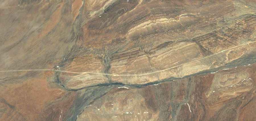
The climb starts from the legendary G219 National Highway and stretches for a massive 50.6 km (31.4 miles) to reach the summit. While the track is mostly straight, the sheer distance at this altitude makes it an exhausting grind. You are heading toward the lake of Salikyila Genzhi Tso (Surigh Yilganing Kol) through a high-altitude desert where time seems to stop. Don't let the "straight" sections fool you; the ground is often soft and dusty, and every kilometer you gain makes the air thinner, forcing your engine to work twice as hard to maintain any kind of momentum.
Is the road to Bayi Daban unpaved?
The entire route is strictly unpaved. It’s a raw track made of dirt, sand, and crushed rock that has seen very little maintenance. Because of the extreme cold and the arid atmosphere, the surface can be deceptively hard-packed one minute and turn into a "dust trap" the next. A high-clearance 4x4 is non-negotiable here. You are driving through one of the most inhospitable environments on Earth, and a simple mechanical failure like a punctured tire or a broken axle can become life-threatening in minutes. There are zero facilities—no electricity, no water, and certainly no help if you get stuck.
What are the hazards when driving to Bayi Daban?
The number one hazard at Bayi Daban is the extreme altitude. At over 5,300 meters, altitude sickness (AMS) isn't just a possibility; it’s a guarantee if you aren't properly acclimated. Your brain will slow down, and your decision-making will be impaired just when you need to be sharpest. The weather is another killer; even in the middle of summer, nighttime temperatures drop well below -20°C, and sudden blizzards can bury the track in a heartbeat. The wind up here is relentless, often carrying fine dust that can clog your air filters and reduce visibility to zero. You must be 100% self-sufficient with food, fuel, and emergency oxygen.
Is the drive to Bayi Daban worth the effort?
For those who want to see the wild, untouched heart of the Kunlun Mountains, this road offers views of high mountain lakes like Songmuxi Co that few humans ever witness. But this is a journey of endurance, not a sightseeing tour. You need to respect the silence of the high plateau. Ensure your vehicle’s cooling system and battery are in perfect shape, as the cold and the thin air will find any weakness instantly. In Tibet and Xinjiang, the mountain doesn't care about your courage; it only cares about your preparation. Take it slow, watch your oxygen levels, and stay sharp. The road is a success only if you make it back to the G219.
Driving through the Aksai Chin and the Ngari Prefecture is a masterclass in survival. The road to Bayi Daban is a reminder of how raw and unforgiving the Earth can be at its highest limits. Check your spare tires, bring twice the water you think you need, and never underestimate a change in the clouds. Out here, you are on your own. Stay alert and enjoy the absolute isolation of the high peaks.
Road suggested by: Hugh Wilson