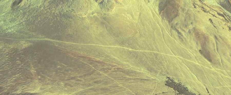
Is the unpaved road to Dingo La in Tibet dangerous?
Dingo La is an extreme high-mountain pass reaching a staggering elevation of 5,047m (16,558ft) above sea level in Rutog County, within the Ngari Prefecture of Tibet. This remote crossing is tucked away in the far western corner of the Tibetan plateau, a place where the landscape is as beautiful as it is lethal for an unprepared vehicle. Reaching the summit means driving through a high-altitude desert where the track is barely visible and the mechanical strain of operating at over 5,000 meters becomes a constant threat to your journey.
| Road facts: Dingo La | |
|---|---|
| Location | Rutog County, Ngari (Tibet) |
| Elevation | 5,047 m (16,558 ft) |
| Length | 16.7 km (10.3 miles) from Bangong Co |
| Elevation Gain | 782 meters |
| Surface | Unpaved / Rocks / Loose Sand |
How long is the 16.7 km climb to Dingo La?
The drive to the summit begins on the northern shore of the Bangong Co lake, following a turn-off from the Banying Highway. The 16.7 km (10.3 miles) ascent is a slow, grueling crawl that gains 782 vertical meters. While the average gradient of 4.68% sounds manageable on paper, the reality of the terrain is much harsher. The track is entirely unpaved and consists of sharp rocks and patches of soft, wind-blown sand. At 5,047 meters, your engine will lose roughly 50% of its power, making even the gentlest slopes feel like a vertical wall. You will need to keep a steady foot on the gas to avoid getting bogged down in the loose sections of the Ngari desert.
What are the road conditions near the summit of Dingo La?
The road to Dingo La has remained largely unchanged since the Austrian zoologist Erich Zugmayer traveled this pass in 1906. There is no modern maintenance here; the track is a primitive line carved by the passage of a few local trucks and nomads. The surface is littered with jagged stones that can easily shred a standard tire sidewall. A high-clearance 4x4 is not just recommended, it is mandatory. You must navigate around deep ruts and dry washouts that can high-center your vehicle, leaving you stranded in a place where help is days away. The exposure is constant, and the wind on the upper ramps can be strong enough to destabilize a high-profile vehicle.
Why is the altitude of Ngari a survival factor?
Reaching the 5,047m mark at Dingo La is a massive physiological test. The air is dangerously thin, and Acute Mountain Sickness (AMS) is a very real danger for anyone who hasn't spent weeks acclimatizing in the Ngari Prefecture. Mechanically, the lack of oxygen means your radiator has to work twice as hard to keep the engine cool, even in the freezing temperatures of the Tibetan plateau. If your cooling system is not 100% sound, the 16.7 km climb will make it boil over. Carrying extra water, fuel, and survival gear is the only way to drive this route safely, as there is zero cell service and no reliable maps for the maze of tracks around Bangong Co.
When is the best time to drive to Dingo La?
The pass is only accessible during a very narrow window in the summer months, usually between late June and September. For the rest of the year, Dingo La is a frozen wasteland, buried under snow and ice that makes the 16.7 km track completely invisible. Even in July, sudden blizzards can hit the 5,000-meter summit without warning. If the ground is wet, the silty soil of the plateau turns into a greasy trap that provides zero traction. Before leaving the Banying Highway, you must be certain of a clear weather window; if you get caught in a storm at the top of Dingo La, the descent back to the lake becomes a lethal slide down a rocky mountain face.
Road suggested by: Hugh Wilson