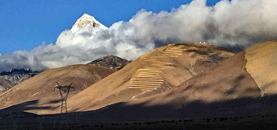
Bangmeilong Peak: Driving the 44 hairpin turns to the Tibet Observatory
Bangmeilong Peak is an extreme high-altitude summit located in Yadong County, within the Tibet Autonomous Region of China. Reaching an elevation of 5,190m (17,027ft) above sea level, the peak sits in the strategic Chumbi Valley near the Bhutanese border. The road to the summit is a high-mountain service track that leads to an astronomical observatory, offering one of the most visually stunning and technically demanding zig-zag climbs in the Himalayas.
| Road facts: Bangmeilong Peak | |
|---|---|
| Location | Yadong County, Tibet (China) |
| Max Elevation | 5,190m (17,027ft) |
| Length | 12.5 km (7.7 miles) |
| Hairpin Turns | 44 technical bends |
How challenging is the 44-hairpin climb to Bangmeilong Peak?
The ascent to Bangmeilong Peak begins in the town of Phari (Pagri) and covers 12.5 kilometers of unpaved mountain terrain. The road features 44 sharp hairpin turns carved into the barren mountain face. From a distance, the track appears as a tight, continuous zig-zag that gains elevation rapidly. Managing these 44 bends requires a vehicle with a tight turning circle and precise throttle control, as the surface consists of loose dirt and mountain scree that offers very little lateral grip during the tightest maneuvers.
Why is oxygen deprivation a factor on the road to Bangmeilong?
Reaching an elevation of 5,190 meters places immense physiological and mechanical stress on the drive. At this altitude, the notorious absence of oxygen means that internal combustion engines lose nearly half of their sea-level power. The 12.5km climb maintains an average gradient of 7.4%, but several ramps hit 11.7%. Tackling these gradients in thin air requires a high-clearance 4x4 with a perfectly maintained cooling system. For the driver, the lack of oxygen can lead to rapid fatigue and impaired judgment, making the navigation of the unprotected shelf sections even more hazardous.
What are the hazards of the Chumbi Valley high-altitude track?
The road to the summit observatory is completely exposed to the extreme weather of the Himalayas. Sudden snowstorms or high-velocity winds can turn the unpaved track into a lethal trap in minutes. The track is narrow, with vertical drops and no safety barriers, dominated by the imposing presence of the 7,000m high Chomo Lhari peak. Because the road is a dead-end serving only the observatory and military interests, maintenance is inconsistent. Large rocks often wash down onto the hairpins, and the spring thaw can turn sections of the 11.7% ramps into unstable mud slides that are impassable for standard vehicles.
What mechanical preparation is needed for the Bangmeilong Peak?
Driving to 5,190 meters is a journey into a high-consequence environment where self-sufficiency is mandatory. The technical integrity of your 4x4 suspension and the condition of your tires are the only guarantees of reaching the summit. You must carry extra fuel, spare tires, and recovery gear, as the isolation of Yadong County means help is hours or days away. The descent from Bangmeilong Peak is as taxing as the climb; using engine braking is the only way to safely manage the descent through the 44 hairpins without risking terminal brake fade on the steep unpaved gradients.
Road suggested by: jorge manuel gómez sánchez
Pic: p. pc高手