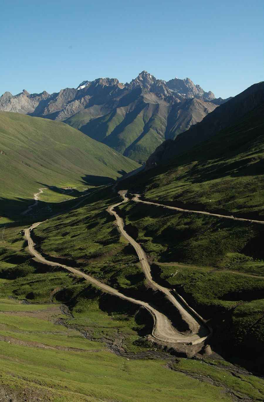
How to drive the nice turns on the way to Lumu La?
Lumu La is a high mountain pass at an elevation of 4.797m (15,738ft) above sea level, located in Sichuan, in the Tibetan Autonomous Prefecture of China.
Where is Lumu La?
The pass is located on the boundary between Xinlong and Garzê counties, in the central part of the country.
Is Lumu La unpaved?
The road to the summit is totally unpaved and very curvy, with countless hairpin turns and steep parts. It’s called Ganbai Road. 4x4 vehicle recommended.
How long is Lumu La?
The pass is 47.0 km (29.2 miles) long, running from Yinduoxiang (Xinlong County, Garzê Tibetan Autonomous Prefecture, Sichuan) to Galaxiang (Garzê County, Garzê Tibetan Autonomous Prefecture, Sichuan) on the G317 Road.
Is Lumu La open?
It’s totally impassable in winters and very remote. Due to its challenging conditions, the road was bypassed by the S455 Road.
Road suggested by: Hugh Wilson
Pic: Xuehai Ouyang