How is the drive through Gele La pass on the G317?
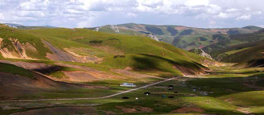
Crossing the Gele La is a test of mechanical and physical endurance in the heart of the Tibet Autonomous Region. At an elevation of 4,369m (14,333ft) above sea level, this pass in Jomda County is a critical and high-risk point on the legendary China National Highway 317. It is a route where the vastness of the Tibetan plateau meets the raw engineering challenges of high-altitude asphalt, offering a driving experience that is as breathtaking as it is exhausting.
| Road facts: Gele La | |
|---|---|
| Location | Jomda County, Tibet (China) |
| Elevation | 4,369m (14,333ft) |
| Road Name | China National Highway 317 (G317) |
| Length | 41 km (25.5 miles) |
| Surface | Paved (Subject to ice and frost heave) |
How challenging is the China National Highway 317 through Gele La?
The China National Highway 317, also known as the Northern Sichuan-Tibet Highway, is famous for its isolation and rough conditions. The section over Gele La spans 41 km (25.5 miles) between the settlements of Qu’nyido and Kargang. While the road is officially paved, the extreme environment means the asphalt is rarely smooth. Frost heaves and cracks caused by the freeze-thaw cycle of the Tibetan plateau create an unpredictable surface that can bounce a vehicle toward the edge if taken too fast.
What are the main hazards of driving Gele La at 4,300 meters?
The primary hazard is the altitude itself. At 4,369 meters, the lack of oxygen is a constant struggle for both humans and machinery. Non-turbocharged engines will lose a significant percentage of their power, making the steep climbs feel endless. Drivers often report symptoms of altitude sickness, which can lead to slowed reaction times on a road that demands precision. The G317 through this pass is carved into steep slopes with minimal protection, where the drop-offs into the deep valleys of Chamdo are unforgiving. In winter, the entire stretch becomes a sheet of black ice, making traction almost impossible without chains.
What is the traffic like on the road to Gele La?
Expect to share this narrow strip of asphalt with heavy Chinese military convoys and massive logistics trucks. These drivers are often under tight schedules and may not yield on the tightest corners. The combination of slow-moving trucks struggling with the thin air and impatient local traffic makes overtaking on the Gele La a high-risk maneuver. Dust, sudden fog, and the glare of the high-altitude sun can also blind you momentarily, adding another layer of danger to the hairpins that define this climb.
When should you avoid the Gele La pass?
Severe weather can close the pass in a matter of minutes. Snowfall is common even outside the winter months, and once the pass is covered, the 41-km journey can take an entire day to complete—if you don't get stuck. Before heading out from Qu’nyido, it is vital to check the local reports for Chamdo. If there is a blizzard predicted, do not attempt the crossing. The remote nature of Jomda County means that if your vehicle breaks down or you slide off the asphalt, help is a very distant prospect in a land where the weather rules the road.
Driving through Gele La is about managing the mechanical limits of your vehicle. When you start the long descent toward Kargang, you will notice the brake pads heating up quickly due to the continuous friction required on the steep hairpins. Monitor your engine temperature constantly, as the thin air at this altitude reduces cooling efficiency significantly. Keep a steady pace, watch the tire pressure, and stay focused on the asphalt conditions to avoid sliding on the frost heaves that define this section of the G317.
Road suggested by: Hugh Wilson
Pic: Carl Parker