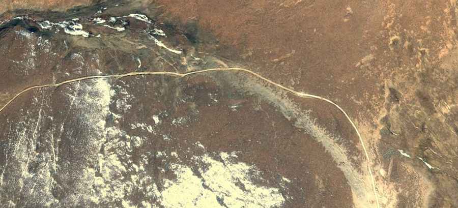
Driving the steep road to Dangbe La
Dangbe La is a high mountain pass reaching an elevation of 5,183m (17,004ft) above sea level. It is located in Xaitongmoin County (also known as Zhetongmön), within the Xigazê Prefecture of the Tibet Autonomous Region in China. Situated northwest of Shigatse, this pass crosses a rugged and isolated section of the Tibetan Plateau.
| Road facts: Dangbe La | |
|---|---|
| Location | Xaitongmoin, Tibet (China) |
| Length | 34 km (21.12 miles) |
| Elevation | 5,183 m (17,004 ft) |
| Road Name | X201 (County Road) |
| Surface | Unpaved (4x4 required) |
| Hazard Level | High (Altitude & Seasonal closures) |
Is the road to Dangbe La paved?
No, the road to the summit is entirely unpaved. Known as the 201 County Road (X201), the surface consists of dirt and gravel, which becomes particularly challenging due to the steepness of the terrain. A 4x4 vehicle is mandatory for this journey. At an altitude exceeding 5,000 meters, drivers must also account for a notorious lack of oxygen and extreme weather conditions that can change rapidly, regardless of the season.
How long is the road to Dangbe La?
The road through the pass is 34 km (21.12 miles) long, connecting the settlements of Cuobuxixiang and Nadangxiang. Because of the high-altitude environment, accessibility is largely limited to the summer months. During the rest of the year, heavy snow and ice often make the X201 road impassable for standard traffic.
What are the driving conditions like on the X201 road?
Driving the X201 over Dangbe La requires a high level of concentration and a vehicle in peak mechanical condition. The combination of sustained steep gradients and the thin air at the summit tests engine combustion and cooling systems. The remote nature of Xaitongmoin County means there is no service or support along this 34 km stretch, making self-sufficiency essential for any driver.
Road suggested by: Hugh Wilson