Yarto Drak La: A Paved 5,038m Mountain Pass in Tibet
At an elevation of 5,038m (16,528ft) above sea level, Yarto Drak La is a high mountain pass located in Qusum County, within the Tibet Autonomous Region. The pass is a key feature of the S202 Road, positioned between the Nedong and Qusum counties in the Yarlung Valley.
| Road facts: Yarto Drak La | |
|---|---|
| Elevation | 5,038 m (16,528 ft) |
| Location | Qusum County, Tibet |
| Notable Features | Zhalacuo Lake / Yarlha Shampo view |
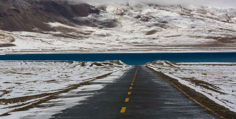
Driving to the Yarto Drak La Summit
The road to the summit is fully paved and runs through a series of remote, desolate valleys. At the highest point of the pass, drivers will find Zhalacuo Lake, a high-altitude water body. The route passes in close proximity to Yarlha Shampo, a 6,636m peak of immense historical significance. While the pavement is in good condition, the 5,000m altitude puts significant stress on the vehicle's aspiration system and cooling efficiency.
Winter Conditions and Access
Snowfall is frequent at Yarto Drak La, making the steep ramps slippery and hazardous. The pass is situated north of the higher Shobo La, acting as the first major elevation obstacle when traveling south from Shannan. During the winter months, traction is reduced, and specialized winter tires are recommended to navigate the 5,038m summit safely.
Road suggested by: Hugh Wilson
Pic: 全珍珠