How to drive the unpaved road to Shargang La in Tibet?
Shargang La is a high mountain pass at an elevation of 5.335m (17,503ft) above sea level located in Banbar County, Chamdo Prefecture in the Tibet Autonomous Region of China.
Where is Shargang La?
The pass, also known as Xia Gongla and Xar Kangla, is located in the south-central part of the country. Xia Gongla Mountain means "East Snow Mountain" in Tibetan.
Is Shargang La unpaved?
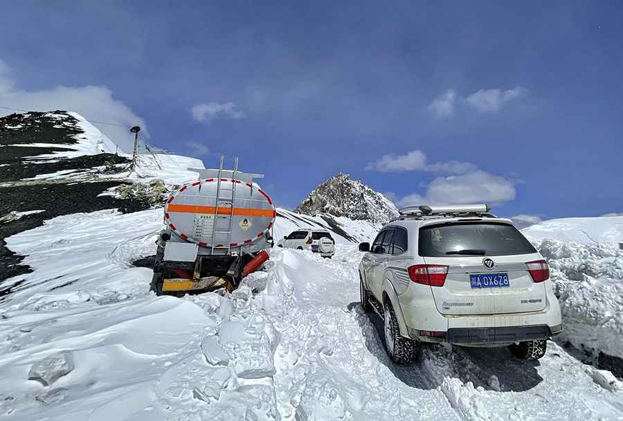
The road to the summit is totally unpaved and pretty steep with more than 50 hairpin turns. It was built in October 2000. It’s called 583 Country Road.
How long is Shargang La?
The pass is 34.4 km (21 miles) long running from Taoqiuge to Zhama'er. The road can only be driven by off-road vehicles. Small cars are not good. The scenery along the way is really beautiful, surrounded by snow-capped mountains, and the air is clean and dusty.
What’s the Shargang La Tunnel?
This is a road to be abandoned. A tunnel is being dug under the mountain, at 4.750 meters (15,583ft) above sea level, and the road here is basically no longer repaired. The new Xia Gongla Mountain Tunnel will be 4.392 meters long. It will adopt a single tunnel and two directions, with a limit of 9 meters in width and 5 meters in height. The seismic fortification intensity of the tunnel structure is 7.
Road suggested by: Hugh Wilson
Pic&more info: https://inf.news/en/travel/a69f94897da995dbb92e0b87e8714220.html