Lhamonyin Shan, the road to the holiest lake in Tibet
Lhamonyin Ri is a high mountain peak at an elevation of 5.226m (17,145ft) above sea level, located in Gyaca County in Shannan Prefecture (Lhoka) of Tibet, in China. Due to the high altitude and extreme weather you should prepare well before.
Why is Lhamonyin Shan famous?
The pass is the main gate to a stunning azure diamond lake known as Lhamo La-tso. It’s said to be the most important and sacred lake for Tibetan Buddhism. Lhamo Latso means 'auspicious heavenly mother lake' or 'numinous mother lake' in Tibetan.
Is the road to Lhamonyin Shan paved?
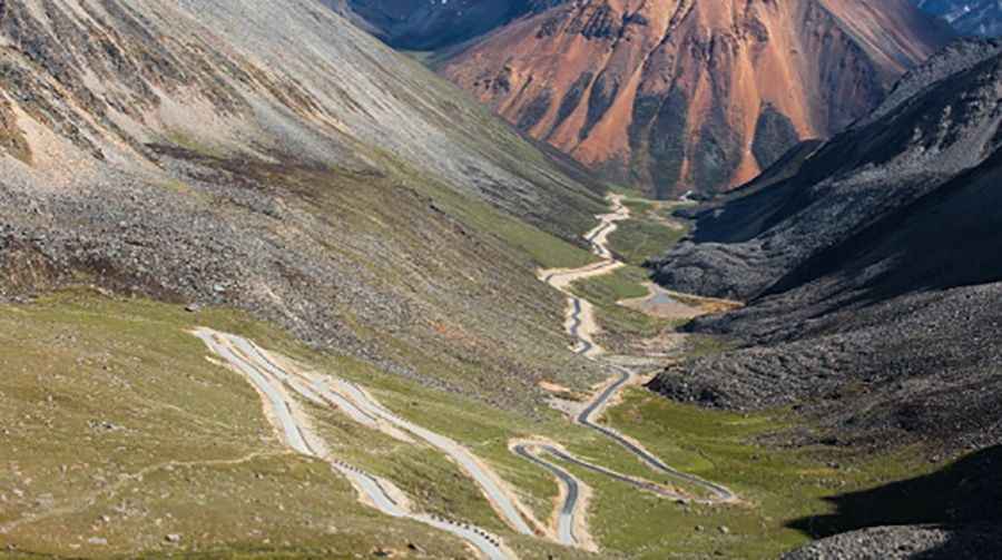
Set high in the mountains of Gyacha County, the winding and curvy road to the summit was fully paved in 2010. The road features 20 hairpin turns.
How long is the road to Lhamonyin Shan?
The road to the summit is very steep. Starting from Cuijiuxiang, the road is 12.6km (7,82 miles) long. Over this distance the elevation gain is 641 meters. The average gradient is 13.98%.
Can I drive the road to Lhamonyin Shan?
It’s only open for pilgrims and Chinese travelers.
Is the road to Lhamonyin Shan open year-round?
Due to its elevation be prepared for the possible High Altitude Sickness. In winters the access is blocked by the heavy snows. The weather changes highly. Be prepared for the cold, wind and rain. The lake surface keeps on freezing for about 7 months, and the best time to visit this lake is from June to August.
Road suggested by: jorge manuel gómez sánchez
Pic: 全珍珠