How to drive the military road to Tun Jun La?
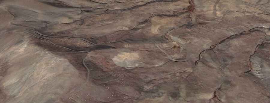
Tun Jun La is an international high-altitude mountain pass at an elevation of 4,976m (16,325ft) above sea level, situated on the border between India and China. Located in the Kumaun Himalayas and the Ngari Prefecture of Tibet, the pass is served by an unpaved military road. This route is a critical tactical corridor and is strictly closed to foreigners. Logistically, the road is only suitable for specialized 4x4 vehicles due to the extreme altitude, steep gradients, and the total absence of civilian infrastructure along the 19.5 km transit.
| Road facts: Tun Jun La | |
|---|---|
| Location | India-China Border (Kumaun Himalayas) |
| Elevation | 4,976 m (16,325 ft) |
| Length | 19.5 km (12.1 miles) |
| Max Gradient | 12% |
| Surface | Unpaved / Military grade |
What are the driving logistics of the 12% gradients on Tun Jun La?
The 19.5 km road from Garzona to the summit of Tun Jun La features some sections with a gradient up to 12%. Logistically, this requires a vehicle with a high-torque-to-weight ratio. On the unpaved surface, maintaining a steady speed is a technical priority to prevent the wheels from digging into the loose Himalayan soil. A 4x4 system with locking differentials is mandatory, as the steepness combined with the high altitude makes any loss of momentum a significant mechanical risk. Drivers must use low-range gears to ensure the engine stays within its optimal power band while managing the +387 m and -866 m elevation shifts.
How does the 4,976m altitude affect vehicle mechanics on Tun Jun La?
At an elevation of 4,976 meters, the thin air causes a severe reduction in engine power output. Logistically, naturally aspirated engines are not suitable for this route, as they can lose up to 40% of their performance. Turbocharged military-grade engines are necessary to maintain the pressure required for combustion. Technically, the cooling system is also under heavy stress; at this altitude, water boils at a lower temperature, increasing the risk of overheating during the steep 12% climbs. It is a mandatory protocol to monitor the vehicle's telemetry closely throughout the 19.5 km stretch between Garzona and the border crest.
What are the winter closure and climate protocols for Tun Jun La?
Due to its extreme location in the Kumaun Himalayas, Tun Jun La is totally impassable during the winter months. The road is buried under heavy snow, and the lack of civilian clearing equipment makes the sector logistically dead from late autumn to early summer. Even during the operational window, sudden blizzards can occur, dropping visibility to zero. Technical preparation must include carrying extreme-weather survival gear and ensuring the vehicle uses Arctic-grade diesel additives to prevent fuel gelling in sub-zero temperatures. There is no logistical support available in this remote sector, making self-sufficiency a vital requirement.
How to manage military traffic and access on Tun Jun La?
Access to the Tun Jun La road is strictly regulated by military authorities on both the Indian and Chinese sides. Logistically, the road is used for the transport of supplies and troops to high-altitude outposts. Because the track is narrow and unpaved, civilian vehicles (where permitted) must always give way to military convoys. Technically, this requires identifying wide "passing points" in advance, as reversing on a 12% unpaved gradient is extremely dangerous. Any transit requires specialized military permits, and the road can be closed without prior notice due to operational security or rapid changes in the geopolitical situation at the border.
Road suggested by: jorge manuel gómez sánchez