Is the X605 Road to Gyaring Lake safe for 4x4 vehicles?
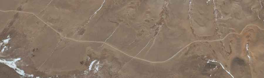
X605 (County Road 605) is a high-altitude unpaved route located in the Nagqu prefecture of Tibet, China. Linking the villages of Shenyaxiang and Xiaguoxiang, the rough dirt track runs entirely above 4,600 meters (15,090 ft) as it climbs through the remote northern plains of the Tibetan plateau.
| Road facts: X605 Road | |
|---|---|
| Location | Nagqu Prefecture, Tibet, China |
| Length | 75.4 km (46 miles) |
| Maximum Elevation | 5,048 m (16,561 ft) |
| Surface | Unpaved (Dirt and loose gravel) |
| Main Hazard | Severe power loss and shoreline mud traps |
What are the engine challenges of driving the X605 Road at 5,000m?
Reaching the peak elevation of 5,048 meters (16,561 ft) starves internal combustion engines of oxygen. The thin air drops engine force significantly, making the vehicle sluggish on the unpaved ramps. Water boils at a much lower temperature up here, putting extreme pressure on your cooling system during slow crawls. Drivers must plan for a 20% to 30% jump in fuel consumption because you will be holding the car in low gears across the entire 75.4 km dirt surface.
What are the terrain hazards along the Gyaring Lake shoreline?
A long sector of the track hugs the southern shore of Gyaring Lake. Water soaking into the roadbed creates patches of deep, deceptive mud that can swallow tires during the spring thaw. The route is cut by frequent water washouts that leave deep ruts and expose jagged rocks. A high-clearance 4x4 with reinforced tires is necessary to avoid puncturing a sidewall or smashing the underbody. There are no tow trucks or garages in this part of Nagqu; you must carry your own winches and sand ladders to get out of trouble.
When is the X605 Road in Tibet blocked by weather?
Heavy mountain snow and deep permafrost freeze the track solid, making it completely impassable from late autumn until late spring. Even during the summer months, violent winds sweeping across the plateau can trigger sudden dust storms or blind blizzards that reduce visibility to zero. The entire 75.4 km route between Shenyaxiang and Xiaguoxiang has zero mobile phone coverage. Drivers must travel with emergency medical oxygen, a satellite radio, and enough food to survive a breakdown on the high plateau.