An Explorer's Guide to the top of Lajyung La
Lajyung La is an international high mountain pass at an elevation of 5.000m (16,404ft) above the sea level, located on the border of China and Nepal.
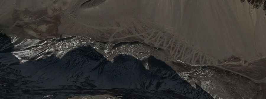
Set high in the Himalaya mountain range, the pass (also known as Lachung La, Laqung and Lajin La) links Gorkha District in the Gandaki Zone of northern-central Nepal and the Tibet Autonomous Region of China. On the Nepalese side there is no road, trail or path. On the Chinese side, the road to the summit is totally unpaved. 4x4 vehicles only. It’s a military road and at the moment is restricted even for the locals. The view is striking and you will also see plenty of blue sheep and Yak making their way in and out of the way. The road is steep (hitting a maximun gradient of 17% through some of the ramps) with uncountable hairpin turns and twists. From the summit, the views are stunning and it’s possible to see the Manaslu, the world’s eighth-highest peak.
Road suggested by: Jorge Manuel Gómez Sánchez