A road with countless curves to the summit of Pele La
Pele La is a high mountain pass at an elevation of 3,423m (11,230ft) above sea level, located in the Wangdue Phodrang District of Bhutan. It’s one of the highest roads in the country.
Where is Pele La?
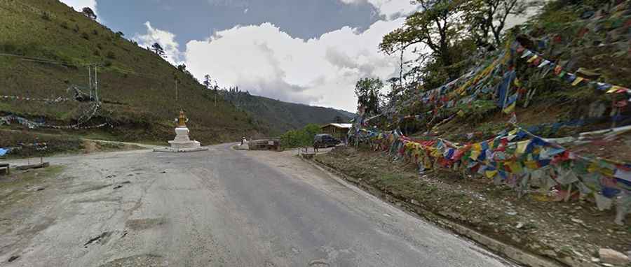
Set high in the central part of the country, the pass takes you over the Black Mountains, the physical boundary between western and central Bhutan. The pass is marked by a chorten and an array of prayer flags. On a clear day (which is rare in these parts), Mount Jhomolhari (7,314m) and Jichu Drakye (6,989m) are visible. A gravel side road at the summit climbs up to 3,568m (11,706ft) to a radio/TV Repeater Station. Very steep and narrow, the track is suitable for 4x4 high-clearance vehicles only.
How long is Pele La?
The road through the pass is 120km (75 miles) long, running west-east from Wangdue Phodrang (the capital of Wangdue Phodrang District) to Trongsa (the capital of Trongsa District).
Is the road to Pele La paved?
The road to the summit is paved in very bad condition (with gravel sections) and is pretty steep, with hundreds of turns. It’s called the Bumthang-Ura Highway. The road was built in the 1990s. It’s a very long and spectacular climb. In countless curves, the road often ascends along the sheer rock face. Located in the Black Mountains, the road is very narrow and is not recommended for passengers prone to car sickness. Be prepared for ice and snow along the way.