Yongphu La: Driving the steep mountain pass of eastern Bhutan
Yongphu La is a high mountain pass at an elevation of 2,610 meters (8,562 ft) above sea level in the Trashigang District of eastern Bhutan. Located along the main highway network in the eastern Himalayas, the narrow, winding route connects Kanglung with Khaling.
| Road facts: Yongphu La | |
|---|---|
| Location | Trashigang District (Bhutan) |
| Elevation | 2,610 m (8,562 ft) |
| Length | 30.5 km (18.9 miles) between Kanglung and Khaling |
| Coordinates | 27°14'30.3"N 91°31'42.4"E |
| Route | Trashigang-Samdrup Jongkhar Highway |
| Surface | Partially paved / Broken asphalt and unpaved dirt |
| Key Hazards | Single-lane bottlenecks, unshielded precipices, monsoon landslides |
Where is the road over Yongphu La located?
The pass is situated in the Trashigang District of eastern Bhutan, positioned along the mountain route connecting Kanglung to Khaling. The road forms a key sector of the main Trashigang-Samdrup Jongkhar Highway traversing the Himalayan ridges.
Is the road over Yongphu La paved?
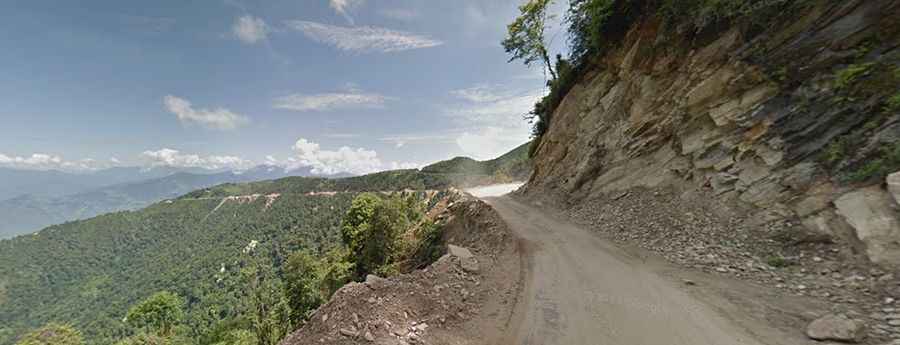
The 30.5-kilometer route consists of partially paved sections mixed with broken asphalt, mud, and unpaved dirt track. The roadbed is carved directly into cliff faces, featuring tight switchbacks and narrow single-lane stretches lacking guardrails or outer shoulder buffers.
What hazards exist when driving Yongphu La?
The primary physical hazards are single-lane bottlenecks over unshielded drops, requiring vehicles to reverse to passing turnouts when encountering oncoming traffic. During the summer monsoon season, heavy rainfall causes landslides and rockfalls that cut off access, while winter conditions bring snow accumulation and icy tracks at the 2,610-meter summit.
How long is the drive over Yongphu La?
The mountain sector spans 30.5 kilometers (18.9 miles) between Kanglung and Khaling. Due to continuous switchbacks, steep gradients, and narrow track widths, completing this section takes over two hours of low-speed driving.