How to drive the paved road to Shertang La?
Shertang La is a high mountain pass at an elevation of 3,573 m (11,722 ft) above sea level, located in Bumthang District, Bhutan. At this altitude, it is one of the highest roads in the country.
Where is Shertang La?
The pass—also known as Shaythang La or Ura La—is situated in the central part of the country. Colorful prayer flags line the summit of the pass.
Is the road to Shertang La paved?
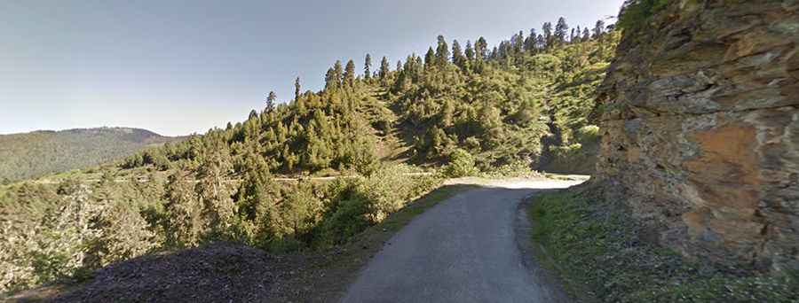
The road through the pass—known as the Bumthang–Ura Highway (part of the Lateral Road)—is mostly paved, though often in very poor condition with broken tarmac and occasional gravel stretches. Built in the 1990s, it is a very narrow and steep route featuring hundreds of sharp turns.
How long is the road to Shertang La?
The road is 47 km (29.2 mi) long, running roughly west-to-east from Jakar (the administrative capital of Bumthang District) to the village of Ura.
Is the road to Shertang La open in winter?
Set high in the Black Mountains, the pass is occasionally closed for a day or two during winter due to heavy snowfall. At this altitude, it is not unusual to encounter lingering snow well into April and May, and the summit is frequently shrouded in thick mist.
Is Shertang La worth the drive?
Yes. The route offers sweeping views over the wide valleys and dense pine forests of Bumthang. Weather permitting, just before reaching the summit you can spot Gangkhar Puensum—at 7,570 m (24,836 ft), the highest unclimbed mountain in the world—dominating the northern skyline, along with the yellow-roofed lhakhang (temple) of Shingkhar village nestled below.