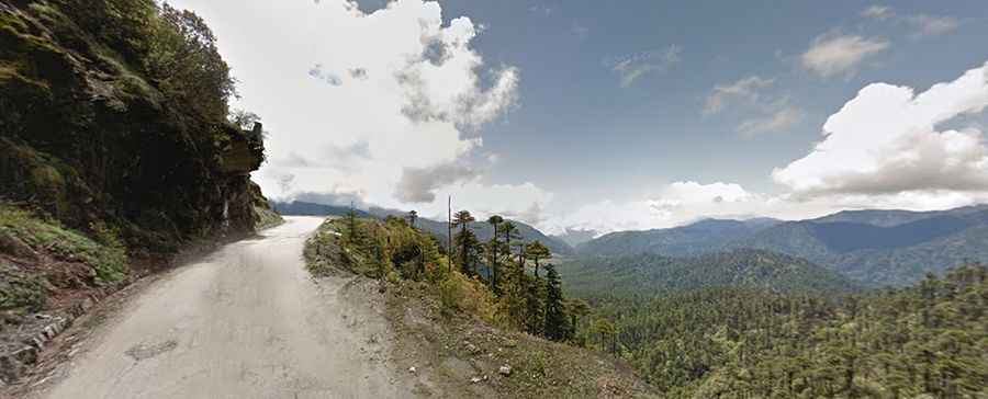
The curvy road to Thrumshing La isn't an easy one
Thrumshing La is a high mountain pass at an elevation of 3,752m (12,309ft) above sea level, located in Bhutan. It’s one of the highest roads in the country.
Where is Thrumshing La?
The pass, also known as Thrumshingla Pass and Donga Pass, is located on the boundary between Bumthang and Lhuentse districts, in the central part of the country, within the Thrumshing La National Park. The pass forms the watershed between Raidāk and Manas River systems. Prayer flags hang on top of the pass.
Is the road to Thrumshing La paved?
Built in the 1990s, the road to the summit is fully paved in very bad condition (even gravel sections) and pretty steep, with thousands of curves (many hairpin turns) and very narrow parts. It’s called Bumthang-Ura Highway (PNH1). The downhill to the east is unbelievable: 3,150m the road drops.
How long is the road to Thrumshing La?
The road through the pass is 256km (159 miles) long, running west-east from Chamkhar to Trashigang, the district capital of the Trashigang Dzongkhag. The road passes through deep forests of Rhododendron trees with monkeys and lots of other exotic voices and prayer flags on the walls.
Is the road to Thrumshing La open in winter?
Set high in the Black Mountains, remember to protect yourself from heavy cold with warm clothes, cap and gloves. The pass is often closed during winter for a day or two due to heavy snowfall. It is quite strange that from early April and May, we do not see snow at this height. Top of the pass is fully covered by mist most of the time.