How to drive the military track to Namgung La
Namgung La is a high mountain pass at an elevation of 4,830m (15,846ft) above sea level, located in the Lhuntse District of Bhutan. It is one of the highest roads of Bhutan.
Where is Namgung La?
The pass, also known as Lengmugong La, is located in the northern part of the country, near the Chinese border.
How long is the road to Namgung La?
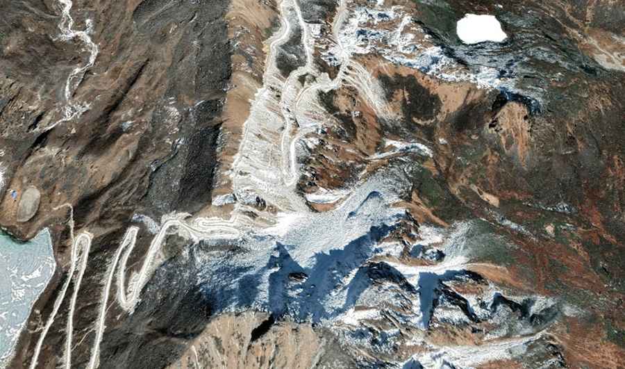
The military road runs for 5.7 km from the border area toward the Leng Mugogcuo lake. It is a dead-end track cleared with heavy machinery, resulting in a surface of loose soil and uncompacted stones. The surface is primitive and lacks any maintenance, as it was built for military access in a remote Himalayan sector.
How steep is the road to Namgung La?
The 5.7 km climb features sustained ramps with a 10% gradient. Wheels spin easily on the uncompacted gravel, especially on the narrow switchbacks where there is no room to maneuver.
How challenging is the road to Namgung La?
The main hazard is the total isolation and the unstable ground. There are no guardrails or safety barriers, and the 5.7 km track is often eroded by mountain weather, creating deep ruts that can hit the vehicle's underbody. On the highest ramps, the roadbed is barely wide enough for a 4x4, with vertical drops and zero passing points.
How remote is the drive to Namgung La?
There are no services, workshops, or fuel points along this route, and it does not appear on standard GPS maps.
What vehicle do I need to reach Namgung La?
A heavy-duty 4x4 with high clearance is mandatory to clear the jagged rocks and ruts of the road.
Road suggested by: Hugh Wilson