The Ultimate Road Trip Guide to Mount Kaputjug
Mount Kaputjugh is a high mountain peak located on the border of Armenia and Azerbaijan.
Where is Mount Kaputjugh?
The peak, known as Qapıcıq dağı, links the Syunik Province of Armenia and the Nakhchivan Autonomous Republic of Azerbaijan. It’s not far from the Iran border.
How to get by car to Mount Kaputjugh?
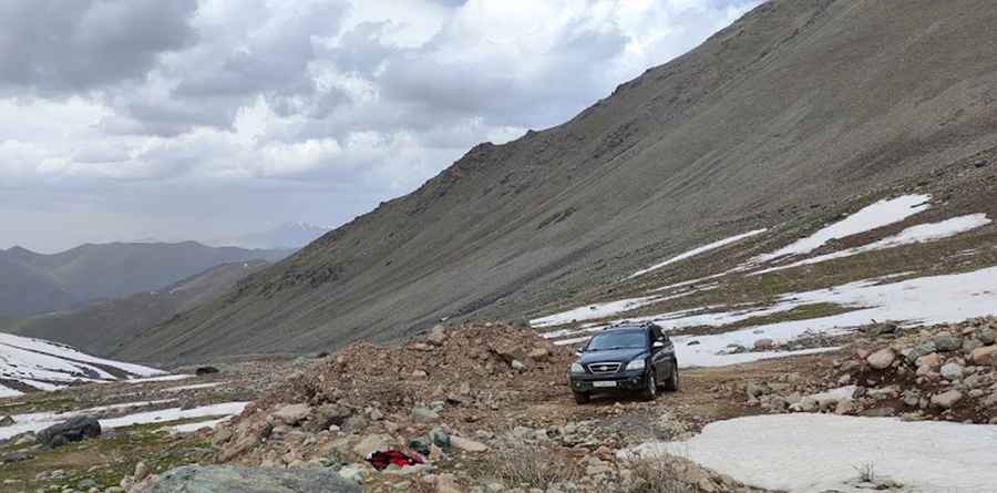
There are two roads to get near the summit, both in Azerbaijan. On the northern side, a road ends at 3,518m (11,541ft) above sea level. Starting from Nəsirvaz, formerly Mesropavan, the road is about 15km (9.32 miles) long. On the southern side, a road ends at 3,517m (11,538ft) above sea level. Starting from Parağaçay, the least populous municipality in the Ordubad District, the road is about 15km (9.32 miles) long. Both roads are entirely unpaved. A 4x4 vehicle with high clearance is required. There’s no road to reach the summit on the Armenian side.
Is the road to Mount Kaputjugh open in winter?
Set high in the Zangezur Mountains of the Caucasus mountain range, the roads are usually impassable from October to June due to the snow. Thunderstorm activity can quickly change unpaved roads to four-wheel-drive conditions or make them impassable.
Pic: Ferrux Aliyarov