Why is the road to Bechenagskiy Pereval closed to traffic?
Bechenagskiy Pereval, also known as the Bichenek Pass, is a high-altitude mountain pass at an elevation of 2,346m (7,696ft) above sea level. Situated on the border between the Nakhchivan exclave of Azerbaijan and the Syunik Province of Armenia, the pass is currently a logistical dead end. Although the physical infrastructure of the R49 and M-13 highways remains, the international border has been strictly sealed for decades due to regional conflict, making a through-transit across the Lesser Caucasus impossible.
| Road facts: Bechenagskiy Pereval | |
|---|---|
| Location | Nakhchivan (Azerbaijan) / Syunik (Armenia) |
| Elevation | 2,346 m (7,696 ft) |
| Status | Border Permanently Closed |
| Surface | Asphalt (Degraded) |
| Access | Dead end from Biçənək or Shaghat |
What is the operational status of the Bechenagskiy Pereval road?
Logistically, the Bechenagskiy Pereval is not a functional transit route. While Google Maps and other navigation systems show the R49 and M-13 connecting, the road terminates at heavily militarized checkpoints on both sides. From the Azerbaijani side, the asphalt is maintained up to the village of Biçənək, but further progress toward the summit is restricted. On the Armenian side, the road from Shaghat faces similar restrictions. Any technical route planning must treat this pass as a "no-through road," as there is no legal or physical mechanism to cross the border line at this coordinate.
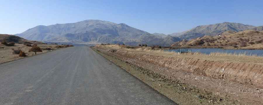
How does the asphalt condition vary on Bechenagskiy Pereval?
Despite the lack of through-traffic, the road surface is paved with asphalt. However, because it is no longer a primary logistical corridor for international trade, maintenance is localized and inconsistent. The 2,346-meter elevation subjects the pavement to extreme freeze-thaw cycles, leading to significant thermal cracking and potholes. In the higher sections of the Shahbuz District, the asphalt has degraded into a high-vibration surface that requires careful speed management to avoid suspension damage. Logistically, drivers approaching the border zone should expect narrow lanes and a lack of modern safety barriers.
What are the winter driving hazards of the Bichenek Pass?
The Bichenek Pass is subject to extreme alpine weather from November through April. At an elevation of 2,346 meters, heavy snow accumulation and "black ice" are constant technical hazards on the asphalt. Logistically, snow-clearing operations are prioritized for local access only and do not extend to the border crest. This means that even if a vehicle reached the upper sections, the road would likely be blocked by uncleared drifts. For any transit in the vicinity, the use of dedicated winter tires is a technical requirement, and carrying recovery gear is mandatory due to the total absence of emergency services in this isolated border buffer zone.
What is the logistical future of the Bechenagskiy Pereval route?
The strategic importance of Bechenagskiy Pereval remains high due to discussions regarding the Zangezur Corridor and other regional transport projects. If reopened, the route would provide a direct asphalt link between Nakhchivan and mainland Azerbaijan via Armenia. However, current logistics are governed by military ceasefire lines rather than civil engineering protocols. Until a formal diplomatic opening occurs, the road remains a tactical dead end. Drivers must also be aware that Azerbaijan maintains its land borders closed under specific state decrees, further complicating the logistics of reaching this high-altitude sector from the west.
Pic: https://static.panoramio.com.storage.googleapis.com/photos/large/98976453.jpg