The road to Omar Pass in Azerbaijan's Lesser Caucasus is only for experienced drivers
Ömər Aşırımı is a high mountain pass at an elevation of 3,252 m (10,669 ft) above sea level, located in the region of Ganja-Gazakh, in Azerbaijan.
Where is Omar Pass?
The pass is located in the western part of the country, within Goygol National Park, straddling the Kalbajar and Goygol districts.
What happened in Omar Pass?
Located to the south of Mount Kapaz, the battle for Omar Pass (winter 1993-1994) is one of the bloodiest episodes of the final phase of the Armenian-Azerbaijani Karabakh war.
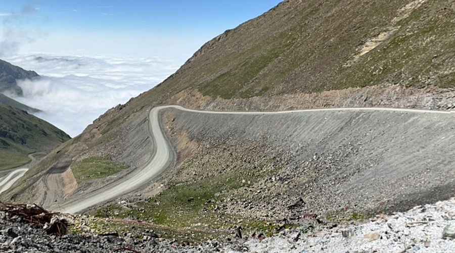
Is the road to Omar Pass unpaved?
The road to the summit is completely unpaved. It’s called R19. It is being improved lately, with the construction of many tunnels.
Is the road to Omar Pass challenging?
The road is challenging. Skilled navigation and guidance are necessary to reach the destination and understand its most interesting features. The rugged path poses risks because of harsh weather conditions like snowstorms, strong winds, fog, limited visibility, black ice in some areas, and possible avalanches.
How long is Omar Pass?
The pass is 75.4 km (46.85 miles) long, running north-south from Goygol (the capital of Goygol District) to Yanşaq (in Kalbajar District).
Is Omar Pass open in winter?
Set high in the Murov range of the Lesser Caucasus, the summit is reached only by four-wheel drive in good weather (the best time to visit is between mid-July and the end of August).
Pic: Eldar Elekberli