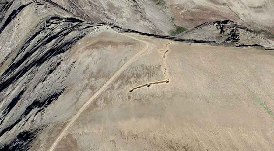
Saridara Pass: Driving the unpaved 3,727m military track
Saridara Pass is a high mountain summit at an elevation of 3,727m (12,227ft) above sea level, located on the border between Armenia and Azerbaijan. The road to the top is a dead-end military track that starts in Gənzə (Ordubad). It is not a transit route between countries; the path stops abruptly at the border line where military installations are located. Driving this track involves a vertical climb of 2,700 meters over a distance of just 25 kilometers.
| Road facts: Saridara Pass | |
|---|---|
| Location | Nakhchivan, Azerbaijan / Armenia border |
| Elevation | 3,727 m (12,227 ft) |
| Avg Gradient | 10.75% (Sustained) |
| Hairpins | 31 tight switchbacks |
Where is the road to Saridara Pass?
The track begins in the village of Gənzə, in the Ordubad District of Nakhchivan. It climbs the southern slopes of the Zangezur Mountains. There is no northern exit; once you reach the summit at 3,727 meters, you must return by the same path. The area is a high-security military zone. Approaching the buildings at the summit is restricted, and border patrols monitor all movements along the ridge line.
Is the road to Saridara Pass paved?
No. The entire 25.1 km route is unpaved. The surface consists of loose shale, sharp volcanic rock, and deep ruts caused by high-clearance military trucks. The 31 hairpins are particularly degraded, with loose stones that make traction difficult on the apex of the curves. A 4x4 with low-range gearing is mandatory; a standard SUV will likely overheat the transmission or damage the oil pan on the rocky steps of the upper sections.
How steep is the climb from Gənzə?
The climb is one of the most sustained in the region, with an average gradient of 10.75%. In several sections, the incline exceeds 15% on loose ground. At over 3,500 meters, engines lose approximately 35% of their power due to the altitude. This requires constant use of low range (4L) to maintain torque and avoid burning the clutch. Fuel consumption will be double the normal rate because of the constant high-rev climbing in low gears.
Can you drive to Saridara Pass in winter?
No. The road is buried under snow from October until June. There is no snow removal service on this secondary military track. Even in mid-summer, the weather at 3,700 meters is unpredictable; sudden storms can turn the dust into slick mud or bring rockfall onto the track, potentially blocking the only way down. The shale on the road is extremely sharp and can cut tire sidewalls easily; carrying a full-size spare and a heavy-duty jack is essential.
What are the hazards of the descent from Saridara?
The primary hazard is brake failure during the 2,700-meter descent. Relying on the brake pedal alone will lead to overheating and fluid boil within minutes. Engine braking is the only safe way to manage the 31 hairpins on the way back to Gənzə. There are no guardrails, and the track is often narrowed by landslides. Due to the lack of mobile signal and the dead-end nature of the road, any mechanical breakdown at the summit is a high-risk situation.