Kovasar: The ultimate ridge climb to Ditavanq Chapel
Mount Kovasar is a prominent peak at an elevation of 2,784m (9,133ft) above sea level, located in southern Armenia. This mountain is a prime destination for off-road enthusiasts due to the challenging track that leads to the Ditavanq mountain chapel at its summit.
Where is Mount Kovasar?
The mountain serves as a natural border point between the provinces of Gegharkunik, Ararat, and Vayots Dzor. The ascent begins near the historic village of Aghnjadzor, famous for its proximity to the medieval Silk Road mountain passes.
🇦🇲 Ditavanq Summit Data
| Elevation | 2,784m (9,133ft) |
| Elevation Gain | 1,425m |
| Distance | 25.8 km (from Aghnjadzor) |
| Max Gradient | 12% |
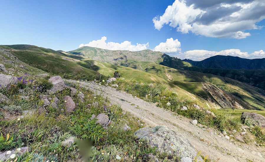
The Drive: 25km of High-Altitude Ridges
The road to the summit is a classic Armenian mountain track: unpredictable, rocky, and stunningly beautiful.
- The Route: From Aghnjadzor, the road spans 25.8 km (16.03 miles) with a total elevation gain of 1,425m.
- Ridge Section: The most spectacular part of the drive follows the high ridges of the mountain range. This means the road is exposed with significant drops on both sides, requiring a driver with no fear of heights.
- Technical Difficulty: While the average gradient is a manageable 5.52%, the track hits maximum gradients of 12% in several sections where the terrain becomes particularly loose and rocky.
Ditavanq: The Watchtower Chapel
At the very top of Kovasar sits the small chapel of Ditavanq. The name, which translates to "Watchtower Monastery," perfectly describes the location. From this 2,784m vantage point, you have a clear line of sight across the Armenian Highlands, making it a historically strategic observation point.
Pic: Transcaucasian Trail