Is the unpaved road to Piramza Pass in Armenia difficult?
Piramza Pass is a high mountain pass at an elevation of 2,795m (9,169ft) above sea level, located in the Syunik Province of southern Armenia. This remote gravel track offers a direct but demanding shortcut through the rugged Armenian Highlands.
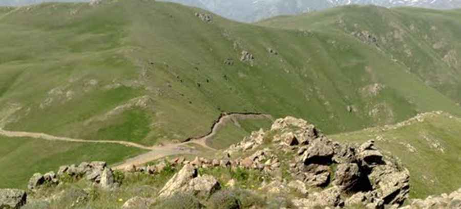
The pass is situated in one of the most mountainous and least populated regions of the country. Driving here is a slow and bumpy experience, where the road surface is often a mix of loose rocks and dirt. Due to its high altitude and isolation, the weather is unpredictable; sudden thunderstorms can turn the dry track into a muddy trap in minutes, making it impassable for anything other than a high-clearance 4x4 vehicle.
| Road facts: Piramza Pass | |
|---|---|
| Location | Syunik Province, Armenia |
| Elevation | 2,795m (9,169ft) |
| Length | 14.9 km (9.25 miles) |
| Hairpin Turns | 26 |
| Surface | Gravel / Rocky |
How long is the road to Piramza Pass?
The road across the pass is 14.9 km (9.25 miles) long, running in a north-south direction between the towns of Geghi and Lernadzor. While it serves as a shortcut between these two points, the time saved in distance is often lost due to the technical nature of the drive. The track is typically impassable from October to June, as heavy snow blocks the high-altitude route for most of the year.
Is the drive over Piramza Pass dangerous?
The drive is notoriously difficult and features a total of 26 sharp hairpin turns. The most defiant section is the last 3.6 km, where the road becomes extremely steep and twists through 18 of those hairpins in a very short distance. In this stretch, the track is narrow with dangerous drops, and the lack of safety barriers means there is zero room for error. Driving at night or in poor visibility is strongly discouraged, as the rocky and bumpy surface requires full concentration to navigate safely.
Road suggested by: Hugh Wilson
Pic: vahan0180