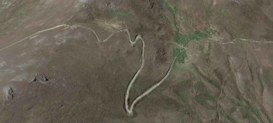
A wild 4x4 road to Ulaghbyur
Ulaghbyur is a high mountain pass at an elevation of 3.568m (11,706ft) above sea level, located in Syunik province of Armenia. It’s one of the highest roads in the country.
Where is Ulaghbyur?
The pass is located to the west of Mount Kaputjugh, in Syunik, the southernmost province of Armenia, near the border with Azerbaijan.
How to get by car to Ulaghbyur?
The road to the summit is entirely unpaved. A 4x4 vehicle with high clearance is required. If your ideal road trip involves getting way off the beaten track then this is the drive for you.
How long is the road to Ulaghbyur?
The road is about 15km (9.32 miles) long starting from Kajaran. The drive provides stunning views of the mountains.
Is the road to Ulaghbyur open in winter?
Set high in the Zangezur Mountains, the road is usually impassable from October to June due to the snow. Thunderstorm activity can quickly change unpaved roads to four-wheel-drive condition or make them impassable.