Road to Ayich’ingil Lerrnants’k’: Driving the 3,466m High Border Track
Situated on the border between the Syunik Province of Armenia and the Nakhchivan Autonomous Republic of Azerbaijan, Ayich’ingil Lerrnants’k’ is a high mountain peak reaching an elevation of 3,466m (11,371ft) above sea level. Located in the Zangezur Mountains (Caucasus range), the road to the summit is one of the highest roads in the country, engineered for high-altitude logistics and border transit.
| Road facts: Ayich’ingil Lerrnants’k’ | |
|---|---|
| Location | Armenia-Azerbaijan Border |
| Elevation Gain | 1,605 m |
| Length | 12.1 km (7.51 miles) |
| Average Gradient | 13.26% |
| Hairpin Turns | 39 technical switchbacks |
| Surface | Unpaved / Loose rock |
How is the road to Ayich’ingil Lerrnants’k’?
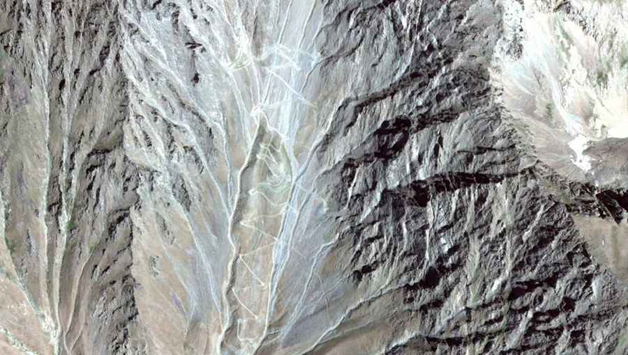
The ascent to Ayich’ingil Lerrnants’k’ starts from Pazmari and covers a distance of 12.1 km (7.51 miles). This is an extremely technical unpaved track that overcomes a massive elevation gain of 1,605 meters. The average gradient is 13.26%, but several ramps exceed 20%, requiring low-range gearing and a high-performance 4x4 system. The track features 39 narrow hairpin turns that are often difficult for long-wheelbase vehicles to navigate without multiple maneuvers. The surface is composed of loose scree and large rock fragments, providing very low traction in steep sections.
What are the main hazards on the Ayich’ingil Lerrnants’k’ track?
The primary hazards on Ayich’ingil Lerrnants’k’ include extreme vertical exposure and severe mechanical stress. The 13.26% average gradient puts immense pressure on the vehicle's cooling system during the climb and the braking system during the descent. There are no safety barriers, and the road bed is subject to constant erosion and landslides due to the unstable nature of the high Caucasus slopes. Additionally, its position on the international border means that military presence and restricted access are frequent; drivers must verify current political status and permit requirements before attempting the 12.1 km climb.
Is the road to Ayich’ingil Lerrnants’k’ open year-round?
No, the track to Ayich’ingil Lerrnants’k’ is impassable for the majority of the year. Due to the 3,466m elevation, the road is typically blocked by deep snow from October to June. Even during the summer months, late snow patches can obstruct the 39 hairpins. High-velocity mountain winds and sudden fog are common logistical obstacles that can reduce visibility to zero. There are no refueling, mechanical, or rescue services available; any vehicle attempting the ascent must be equipped with specialized high-altitude recovery gear and sufficient fuel reserves for the increased consumption caused by the steep incline.
How to drive the 12.1 km track to Ayich’ingil Lerrnants’k’?
Driving the 12.1 km route to Ayich’ingil Lerrnants’k’ requires advanced off-road techniques. Use low-range 4WD from the start in Pazmari to manage the 1,605m elevation gain without stalling. When navigating the 39 switchbacks, precise throttle control is necessary to avoid tire spin on the loose 13.26% ramps. On the return journey, heavy engine braking is mandatory; relying on service brakes will cause immediate overheating and failure. Monitor tire pressure closely, as the sharp rock fragments at 3,466m increase the risk of sidewall punctures. Due to the extreme isolation, it is recommended to travel with at least two vehicles in a convoy.